Chichicastenango night lights from space
Night Light of Chichicastenango (Quiché) from space (Guatemala) Src. Average luminocity for 10x10km area is 3.9463% and for 50x50km: 1.5963%.
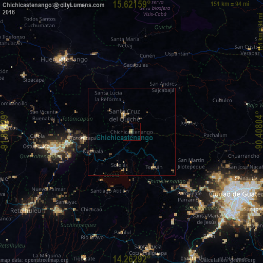
Analysis of Chichicastenango night lights 2016
Square area 10x10 km:
 0%
0%90-99
0%80-89
0.83%70-79
0.21%60-69
1.45%50-59
0%40-49
1.65%30-39
0.83%20-29
0.83%10-19
0.83%0-9
93.39%Square area 50x50 km:
0.05%90-99
0.02%80-89
0.38%70-79
0.17%60-69
0.31%50-59
0.27%40-49
0.31%30-39
0.39%20-29
0.32%10-19
0.39%0-9
97.4%Clear (daylight) street map image can be seen on geolist.org.
Map coordinates:
15° 37' 17.7" North, 91° 48' 51.4" West
14° 56' 36" North, 91° 6' 40.2" West
14° 15' 46.5" North, 90° 24' 28.9" West
Some cities around Chichicastenango sort by population:
• Sololá
20.5 km =12.7 mi,  202°
202°
• Nahualá
24.9 km =15.5 mi,  243°
243°
• Santa Cruz del Quiché
10.5 km =6.5 mi,  337°
337°
• Tecpán Guatemala
23.9 km =14.9 mi,  147°
147°
• Panajachel
22.9 km =14.2 mi,  192°
192°
• Zacualpa
26.7 km =16.6 mi,  69°
69°
• Santa María Chiquimula
25.3 km =15.7 mi,  292°
292°
• San José Poaquil
25.5 km =15.8 mi,  123°
123°
3598655 (p: 79,759)
Sources (retrieved 2019-11-25):
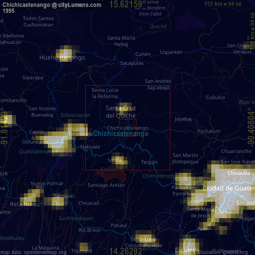
» NASA, Earths city lights 1995
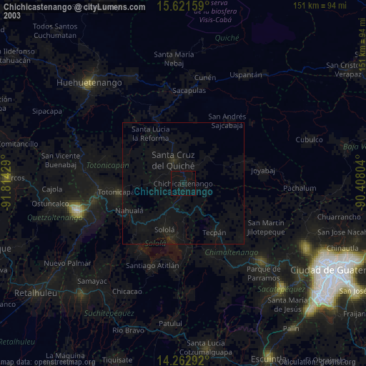
» NASA city lights 2003
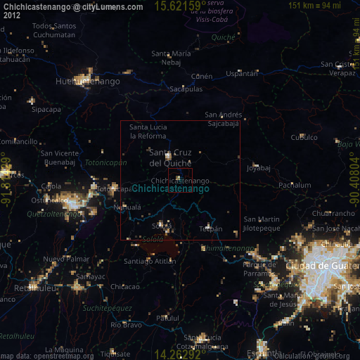
» Earth at Night: Flat Maps 2012, 2016