Villa Canales night lights from space
Night Light of Villa Canales (Guatemala) from space (Guatemala) Src. Average luminocity for 10x10km area is 53.1061% and for 50x50km: 29.6148%.
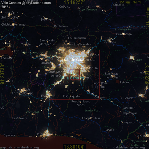

Analysis of Villa Canales night lights 2016
Square area 10x10 km:
 6.28%
6.28%90-99
7.14%80-89
8.01%70-79
5.84%60-69
10.17%50-59
12.77%40-49
15.37%30-39
13.64%20-29
6.93%10-19
13.85%0-9
0%Square area 50x50 km:
6.34%90-99
6.7%80-89
3.79%70-79
3.14%60-69
4.67%50-59
3.32%40-49
3.22%30-39
3.82%20-29
4.8%10-19
11.66%0-9
48.54%Clear (daylight) street map image can be seen on geolist.org.
Map coordinates:
15° 9' 45.3" North, 91° 14' 14.6" West
14° 28' 58.3" North, 90° 32' 3.3" West
13° 48' 3.7" North, 89° 49' 52.1" West
Some cities around Villa Canales sort by population:
• Guatemala City
17.7 km =11 mi,  7°
7°
• Petapa
3.7 km =2.3 mi,  305°
305°
• Amatitlán
10.9 km =6.8 mi,  266°
266°
• Santa Catarina Pinula
10.4 km =6.5 mi,  21°
21°
• San José Pinula
14.8 km =9.2 mi,  61°
61°
• Fraijanes
10.2 km =6.3 mi,  100°
100°
• San Vicente Pacaya
13.3 km =8.3 mi,  235°
235°
• Magdalena Milpas Altas
16.8 km =10.4 mi,  295°
295°
3587923 (p: 122,194)
Sources (retrieved 2019-11-25):
» NASA, Earths city lights 1995
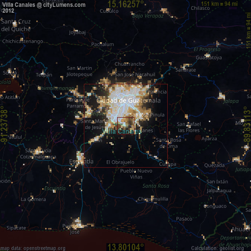
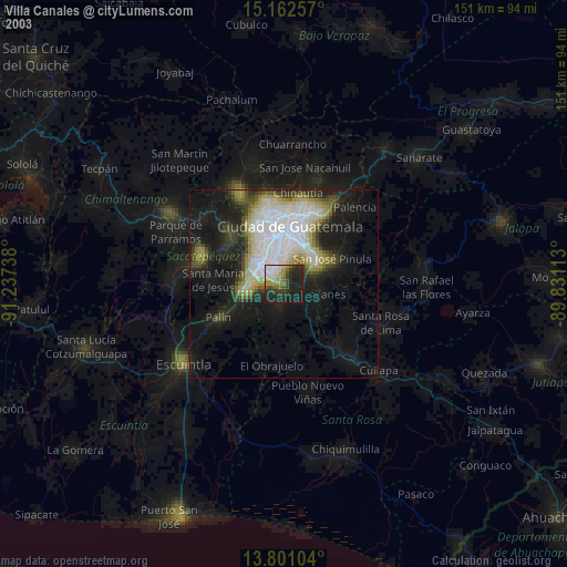
» NASA city lights 2003
» Earth at Night: Flat Maps 2012, 2016