Amatitlán night lights from space
Night Light of Amatitlán (Guatemala) from space (Guatemala) Src. Average luminocity for 10x10km area is 43.7814% and for 50x50km: 31.1925%.
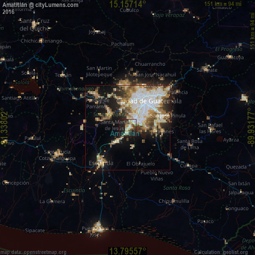
Analysis of Amatitlán night lights 2016
Square area 10x10 km:
 5.41%
5.41%90-99
10.17%80-89
6.06%70-79
6.93%60-69
4.33%50-59
3.46%40-49
5.19%30-39
7.79%20-29
14.72%10-19
35.93%0-9
0%Square area 50x50 km:
6.36%90-99
6.83%80-89
4.2%70-79
3.43%60-69
5.22%50-59
3.68%40-49
3.39%30-39
3.54%20-29
4.69%10-19
13.33%0-9
45.34%Clear (daylight) street map image can be seen on geolist.org.
Map coordinates:
15° 9' 25.7" North, 91° 20' 16.9" West
14° 28' 38.6" North, 90° 38' 5.6" West
13° 47' 44.1" North, 89° 55' 54.4" West
Some cities around Amatitlán sort by population:
• Villa Nueva
7.5 km =4.7 mi,  45°
45°
• Petapa
8.3 km =5.2 mi,  70°
70°
• Villa Canales
10.9 km =6.8 mi,  86°
86°
• Palín
10.6 km =6.6 mi,  218°
218°
• Santa María de Jesús
8.3 km =5.2 mi,  283°
283°
• Santa Lucía Milpas Altas
11.9 km =7.4 mi,  337°
337°
• San Vicente Pacaya
7 km =4.3 mi,  181°
181°
• Magdalena Milpas Altas
8.9 km =5.5 mi,  331°
331°
3599735 (p: 71,836)
Sources (retrieved 2019-11-25):
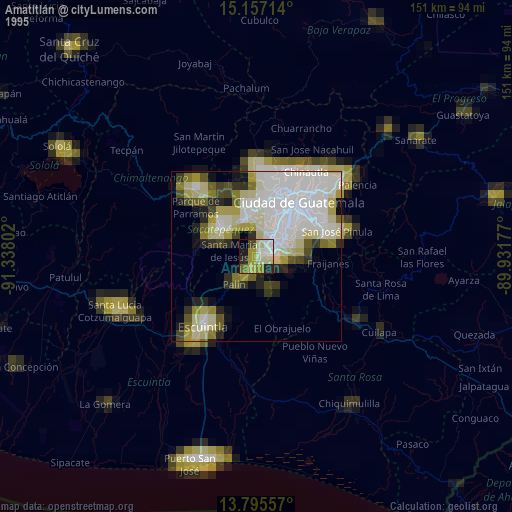
» NASA, Earths city lights 1995
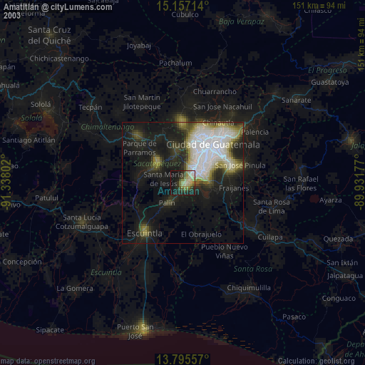
» NASA city lights 2003
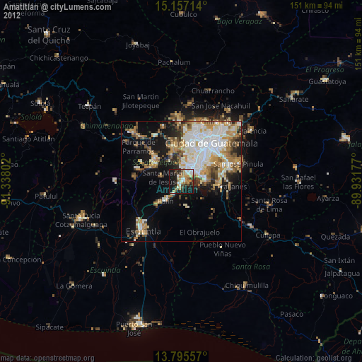
» Earth at Night: Flat Maps 2012, 2016