Guatemala City night lights from space
Night Light of Guatemala City (Guatemala) from space (Guatemala) Src. Average luminocity for 10x10km area is 96.9567% and for 50x50km: 29.2194%.
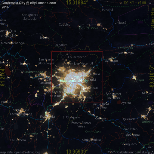
Analysis of Guatemala City night lights 2016
Square area 10x10 km:
 59.09%
90-99
31.17%80-89
4.33%70-79
1.95%60-69
2.6%50-59
0.87%40-49
0%30-39
0%20-29
0%10-19
0%0-9
0%Square area 50x50 km:
6.21%90-99
6.46%80-89
3.46%70-79
3.21%60-69
4.69%50-59
3.22%40-49
3.33%30-39
3.98%20-29
5.97%10-19
12.04%0-9
47.43%Clear (daylight) street map image can be seen on geolist.org.
Map coordinates:
15° 19' 11.8" North, 91° 12' 59" West
14° 38' 26.6" North, 90° 30' 47.8" West
13° 57' 33.8" North, 89° 48' 36.5" West
Some cities around Guatemala City sort by population:
• Mixco
10.2 km =6.3 mi,  263°
263°
• Villa Nueva
15 km =9.3 mi,  211°
211°
• Petapa
16.3 km =10.1 mi,  198°
198°
• Chinautla
7.1 km =4.4 mi,  11°
11°
• Santa Catarina Pinula
8 km =5 mi,  169°
169°
• San José Pinula
15.1 km =9.4 mi,  134°
134°
• San Lucas Sacatepéquez
15.8 km =9.8 mi, 257°
• San Pedro Sacatepéquez
14.8 km =9.2 mi,  289°
289°
3598132 (p: 994,938)
Sources (retrieved 2019-11-25):
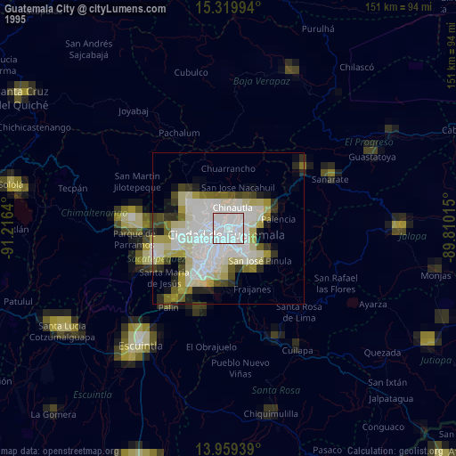
» NASA, Earths city lights 1995
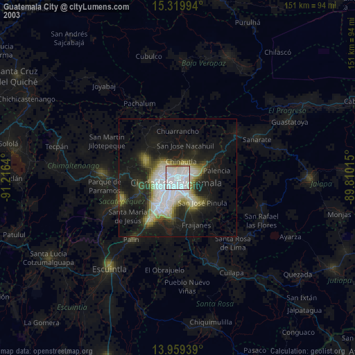
» NASA city lights 2003
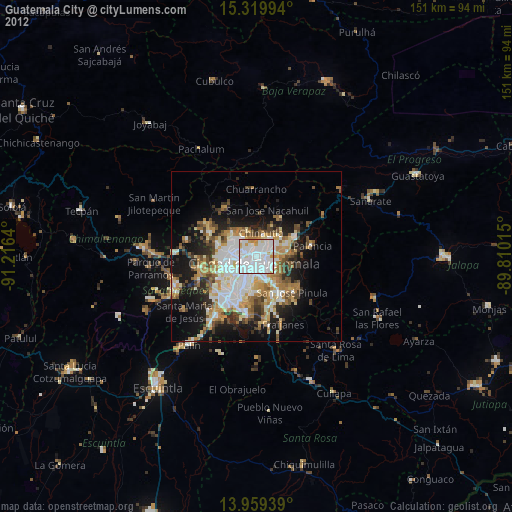
» Earth at Night: Flat Maps 2012, 2016