Fraijanes night lights from space
Night Light of Fraijanes (Guatemala) from space (Guatemala) Src. Average luminocity for 10x10km area is 34.7013% and for 50x50km: 24.877%.
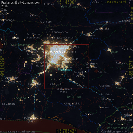
Analysis of Fraijanes night lights 2016
Square area 10x10 km:
 0.43%
0.43%90-99
4.98%80-89
6.93%70-79
5.84%60-69
8.66%50-59
3.68%40-49
2.6%30-39
10.61%20-29
10.82%10-19
25.97%0-9
19.48%Square area 50x50 km:
6.22%90-99
6.27%80-89
3.2%70-79
2.31%60-69
3.7%50-59
2.44%40-49
2.48%30-39
3.03%20-29
3.57%10-19
6.16%0-9
60.61%Clear (daylight) street map image can be seen on geolist.org.
Map coordinates:
15° 8' 42.2" North, 91° 8' 38.3" West
14° 27' 55" North, 90° 26' 27" West
13° 47' 0.3" North, 89° 44' 15.8" West
Some cities around Fraijanes sort by population:
• Villa Nueva
16.9 km =10.5 mi,  293°
293°
• Petapa
13.7 km =8.5 mi, 287°
• Villa Canales
10.2 km =6.3 mi,  280°
280°
• Santa Catarina Pinula
13.3 km =8.3 mi,  331°
331°
• San José Pinula
9.5 km =5.9 mi,  18°
18°
• Barberena
19.5 km =12.1 mi,  154°
154°
• Santa Cruz Naranjo
11.5 km =7.1 mi,  138°
138°
• Santa Rosa de Lima
17.8 km =11.1 mi,  118°
118°
3595714 (p: 28,492)
Sources (retrieved 2019-11-25):
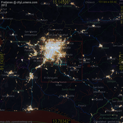
» Earth at Night: Flat Maps 2012, 2016