Santa Catarina Pinula night lights from space
Night Light of Santa Catarina Pinula (Guatemala) from space (Guatemala) Src. Average luminocity for 10x10km area is 87.303% and for 50x50km: 29.8893%.
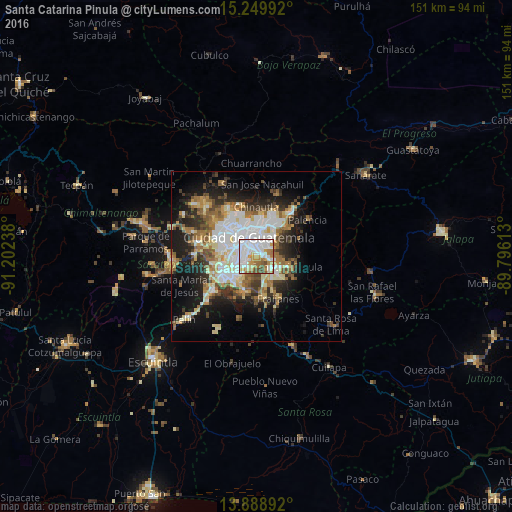
Analysis of Santa Catarina Pinula night lights 2016
Square area 10x10 km:
 33.77%
90-99
28.79%80-89
4.98%70-79
13.42%60-69
11.26%50-59
3.9%40-49
3.9%30-39
0%20-29
0%10-19
0%0-9
0%Square area 50x50 km:
6.25%90-99
6.54%80-89
3.67%70-79
3.1%60-69
4.73%50-59
3.23%40-49
3.53%30-39
4.11%20-29
6.1%10-19
12.23%0-9
46.5%Clear (daylight) street map image can be seen on geolist.org.
Map coordinates:
15° 14' 59.7" North, 91° 12' 8.6" West
14° 34' 13.7" North, 90° 29' 57.3" West
13° 53' 20.1" North, 89° 47' 46.1" West
Some cities around Santa Catarina Pinula sort by population:
• Guatemala City
8 km =5 mi,  349°
349°
• Mixco
13.4 km =8.3 mi,  300°
300°
• Villa Nueva
10.6 km =6.6 mi,  241°
241°
• Petapa
10.2 km =6.3 mi,  221°
221°
• Villa Canales
10.4 km =6.5 mi,  201°
201°
• Chinautla
14.7 km =9.1 mi,  359°
359°
• San José Pinula
9.7 km =6 mi,  106°
106°
• Fraijanes
13.3 km =8.3 mi,  151°
151°
3589452 (p: 67,994)
Sources (retrieved 2019-11-25):
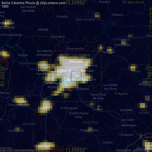
» NASA, Earths city lights 1995
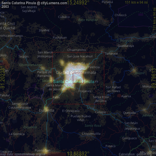
» NASA city lights 2003
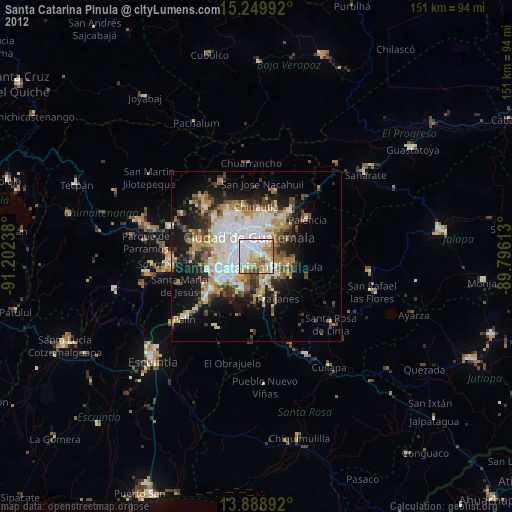
» Earth at Night: Flat Maps 2012, 2016