Villa Nueva night lights from space
Night Light of Villa Nueva (Guatemala) from space (Guatemala) Src. Average luminocity for 10x10km area is 84.9784% and for 50x50km: 32.493%.
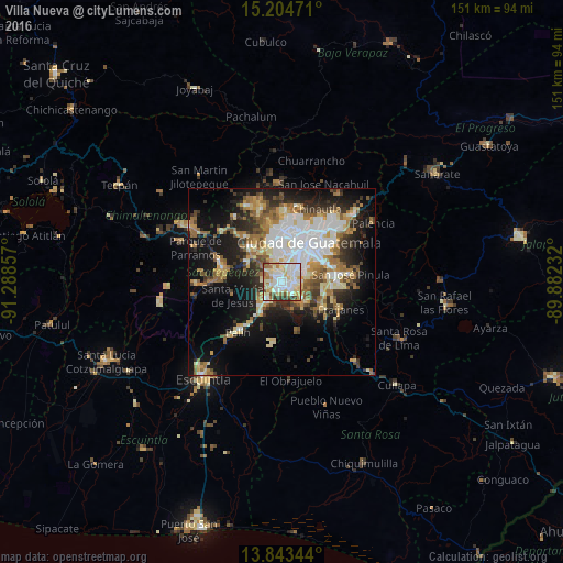
Analysis of Villa Nueva night lights 2016
Square area 10x10 km:
 22.94%
90-99
33.77%80-89
16.23%70-79
8.66%60-69
5.63%50-59
5.41%40-49
3.03%30-39
4.33%20-29
0%10-19
0%0-9
0%Square area 50x50 km:
6.29%90-99
6.75%80-89
4.05%70-79
3.57%60-69
5.44%50-59
3.9%40-49
3.8%30-39
4.2%20-29
6.33%10-19
15.9%0-9
39.76%Clear (daylight) street map image can be seen on geolist.org.
Map coordinates:
15° 12' 17" North, 91° 17' 18.9" West
14° 31' 30.4" North, 90° 35' 7.6" West
13° 50' 36.4" North, 89° 52' 56.4" West
Some cities around Villa Nueva sort by population:
• Mixco
12 km =7.5 mi,  348°
348°
• Petapa
3.6 km =2.2 mi,  135°
135°
• Amatitlán
7.5 km =4.7 mi,  225°
225°
• Santa Catarina Pinula
10.6 km =6.6 mi,  61°
61°
• San Lucas Sacatepéquez
12.2 km =7.6 mi,  321°
321°
• Santa Lucía Milpas Altas
11.3 km =7 mi,  300°
300°
• San Vicente Pacaya
13.4 km =8.3 mi,  203°
203°
• Magdalena Milpas Altas
9.9 km =6.2 mi,  284°
284°
3587902 (p: 406,830)
Sources (retrieved 2019-11-25):
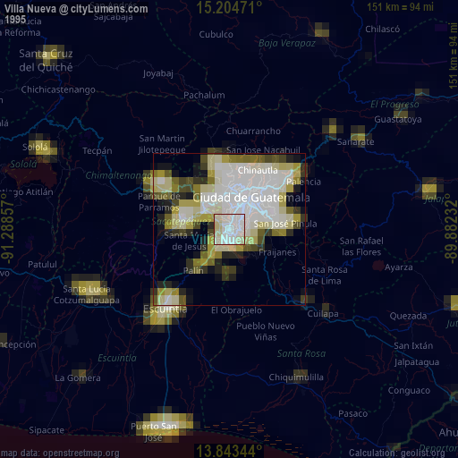
» NASA, Earths city lights 1995
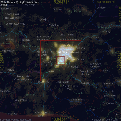
» NASA city lights 2003
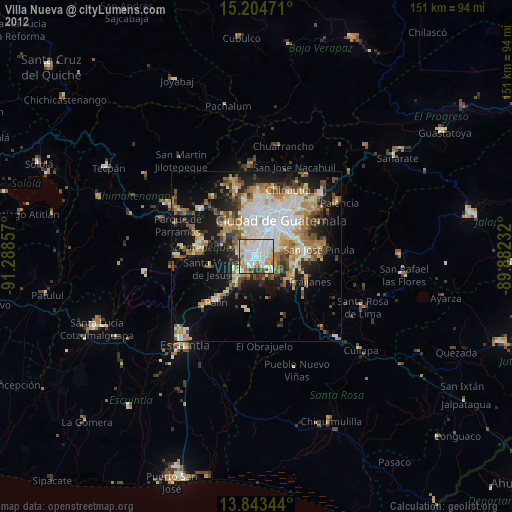
» Earth at Night: Flat Maps 2012, 2016