Mixco night lights from space
Night Light of Mixco (Guatemala) from space (Guatemala) Src. Average luminocity for 10x10km area is 84.6645% and for 50x50km: 31.3621%.
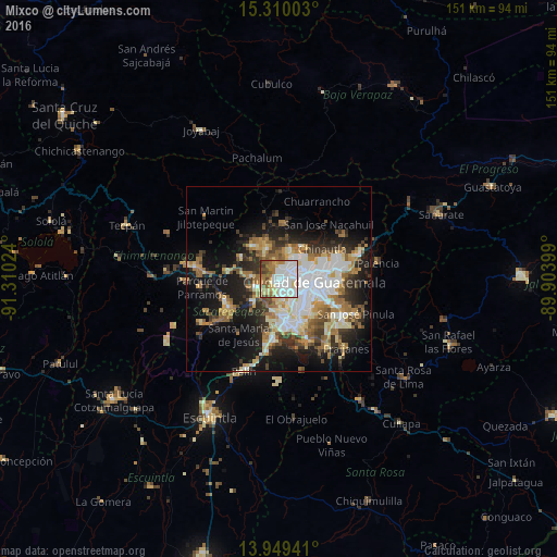
Analysis of Mixco night lights 2016
Square area 10x10 km:
 29.87%
90-99
25.97%80-89
11.9%70-79
4.11%60-69
14.07%50-59
7.79%40-49
3.68%30-39
2.6%20-29
0%10-19
0%0-9
0%Square area 50x50 km:
6.27%90-99
6.55%80-89
3.74%70-79
3.49%60-69
5.25%50-59
3.63%40-49
3.72%30-39
4.23%20-29
6.33%10-19
15.33%0-9
41.46%Clear (daylight) street map image can be seen on geolist.org.
Map coordinates:
15° 18' 36.1" North, 91° 18' 36.9" West
14° 37' 50.8" North, 90° 36' 25.6" West
13° 56' 57.9" North, 89° 54' 14.4" West
Some cities around Mixco sort by population:
• Guatemala City
10.2 km =6.3 mi,  83°
83°
• San Juan Sacatepéquez
10.6 km =6.6 mi,  337°
337°
• Santiago Sacatepéquez
7.5 km =4.7 mi,  273°
273°
• San Lucas Sacatepéquez
5.8 km =3.6 mi,  247°
247°
• San Pedro Sacatepéquez
7.2 km =4.5 mi,  328°
328°
• Santa Lucía Milpas Altas
9.6 km =6 mi,  231°
231°
• Santo Domingo Xenacoj
11.4 km =7.1 mi,  298°
298°
• San Bartolomé Milpas Altas
8.1 km =5 mi, 250°
3592519 (p: 473,080)
Sources (retrieved 2019-11-25):
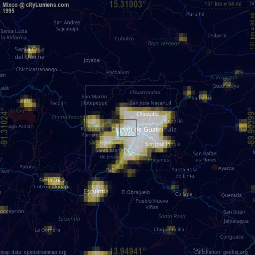
» NASA, Earths city lights 1995
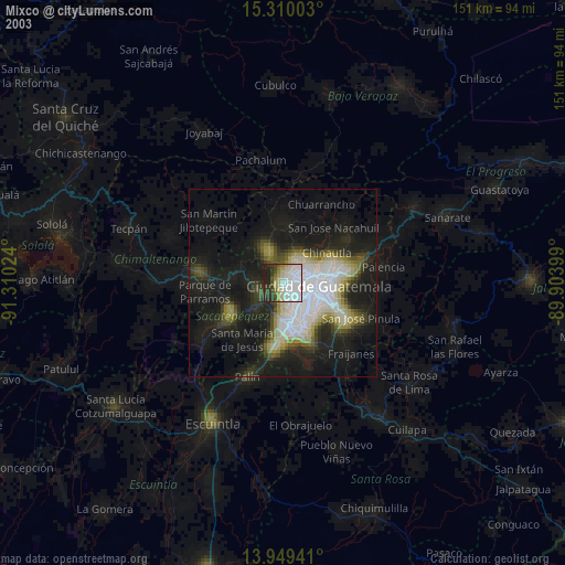
» NASA city lights 2003
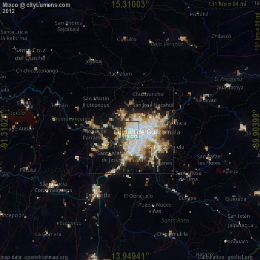
» Earth at Night: Flat Maps 2012, 2016