Santa Catarina Mita night lights from space
Night Light of Santa Catarina Mita (Jutiapa) from space (Guatemala) Src. Average luminocity for 10x10km area is 1.6602% and for 50x50km: 1.8355%.
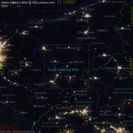
Analysis of Santa Catarina Mita night lights 2016
Square area 10x10 km:
 0%
0%90-99
0%80-89
0%70-79
0%60-69
0.87%50-59
0.87%40-49
0%30-39
0%20-29
0.87%10-19
1.73%0-9
95.67%Square area 50x50 km:
0%90-99
0.11%80-89
0.27%70-79
0.26%60-69
0.31%50-59
0.44%40-49
0.33%30-39
0.44%20-29
0.63%10-19
0.33%0-9
96.88%Clear (daylight) street map image can be seen on geolist.org.
Map coordinates:
15° 7' 47.4" North, 90° 27' 11.3" West
14° 27' 0" North, 89° 45' 0" West
13° 46' 5.1" North, 89° 2' 48.8" West
Some cities around Santa Catarina Mita sort by population:
• Jalapa
32.9 km =20.4 mi,  308°
308°
• Jutiapa
23.6 km =14.7 mi,  221°
221°
• Asunción Mita
13.9 km =8.6 mi,  162°
162°
• Atescatempa
30.7 km =19.1 mi,  178°
178°
• Monjas
13.7 km =8.5 mi,  293°
293°
• San Luis Jilotepeque
22.3 km =13.9 mi,  4°
4°
• El Progreso
15.5 km =9.6 mi, 224°
• Ipala
23.4 km =14.5 mi,  37°
37°
3589456 (p: 10,817)
Sources (retrieved 2019-11-25):
» Earth at Night: Flat Maps 2012, 2016