San Luis Jilotepeque night lights from space
Night Light of San Luis Jilotepeque (Jalapa) from space (Guatemala) Src. Average luminocity for 10x10km area is 1.9004% and for 50x50km: 0.8492%.
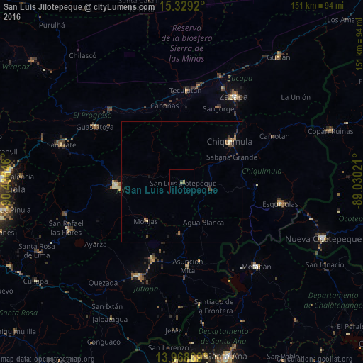
Analysis of San Luis Jilotepeque night lights 2016
Square area 10x10 km:
 0%
0%90-99
0%80-89
0%70-79
0%60-69
1.73%50-59
0.87%40-49
0%30-39
0%20-29
0.65%10-19
0.22%0-9
96.54%Square area 50x50 km:
0%90-99
0.03%80-89
0.1%70-79
0.04%60-69
0.28%50-59
0.14%40-49
0.29%30-39
0.21%20-29
0.16%10-19
0.23%0-9
98.53%Clear (daylight) street map image can be seen on geolist.org.
Map coordinates:
15° 19' 45.1" North, 90° 26' 11.3" West
14° 39' 0" North, 89° 43' 60" West
13° 58' 7.3" North, 89° 1' 48.8" West
Some cities around San Luis Jilotepeque sort by population:
• Jalapa
27.5 km =17.1 mi,  266°
266°
• Chiquimula
26.2 km =16.3 mi,  50°
50°
• Asunción Mita
35.6 km =22.1 mi,  176°
176°
• Santa Catarina Mita
22.3 km =13.9 mi, 184°
• Monjas
22 km =13.7 mi,  220°
220°
• El Progreso
35.6 km =22.1 mi,  200°
200°
• Teculután
37.1 km =23.1 mi,  2°
2°
• Ipala
13.1 km =8.1 mi,  106°
106°
3589822 (p: 10,306)
Sources (retrieved 2019-11-25):
» Earth at Night: Flat Maps 2012, 2016