Asunción Mita night lights from space
Night Light of Asunción Mita (Jutiapa) from space (Guatemala) Src. Average luminocity for 10x10km area is 3.9719% and for 50x50km: 1.8404%.
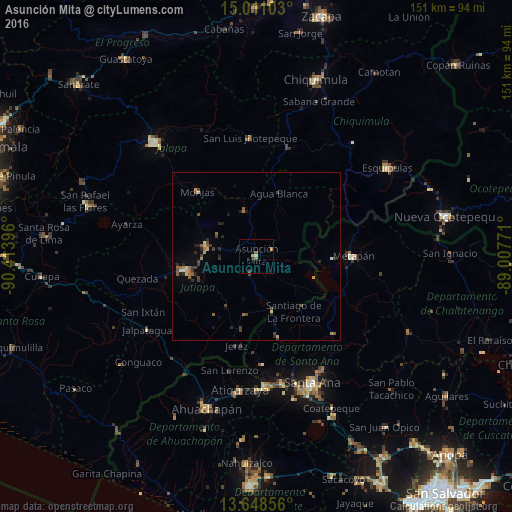
Analysis of Asunción Mita night lights 2016
Square area 10x10 km:
 0%
0%90-99
0%80-89
0.87%70-79
1.73%60-69
0.22%50-59
1.52%40-49
0%30-39
1.3%20-29
0.43%10-19
0.22%0-9
93.72%Square area 50x50 km:
0.02%90-99
0.09%80-89
0.22%70-79
0.33%60-69
0.24%50-59
0.43%40-49
0.48%30-39
0.45%20-29
0.63%10-19
0.35%0-9
96.76%Clear (daylight) street map image can be seen on geolist.org.
Map coordinates:
15° 0' 39.7" North, 90° 24' 50.3" West
14° 19' 51" North, 89° 42' 39" West
13° 38' 54.8" North, 89° 0' 27.8" West
Some cities around Asunción Mita sort by population:
• Jutiapa
20.4 km =12.7 mi,  257°
257°
• Metapán, SV
28.1 km =17.5 mi,  89°
89°
• Atescatempa
17.7 km =11 mi,  191°
191°
• Santa Catarina Mita
13.9 km =8.6 mi,  342°
342°
• Monjas
25.2 km =15.7 mi,  318°
318°
• El Progreso
15.1 km =9.4 mi,  278°
278°
• Candelaria de La Frontera, SV
24.7 km =15.3 mi,  164°
164°
• Ipala
33.4 km =20.8 mi,  17°
17°
3599639 (p: 15,608)
Sources (retrieved 2019-11-25):
» Earth at Night: Flat Maps 2012, 2016