Santa Bárbara night lights from space
Night Light of Santa Bárbara (Suchitepeque) from space (Guatemala) Src. Average luminocity for 10x10km area is 0.526% and for 50x50km: 1.853%.
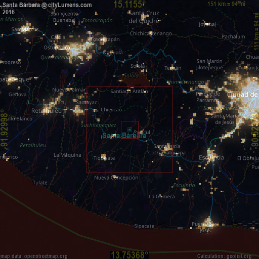
Analysis of Santa Bárbara night lights 2016
Square area 10x10 km:
 0%
0%90-99
0%80-89
0%70-79
0%60-69
0%50-59
0%40-49
0%30-39
0%20-29
0.87%10-19
0.87%0-9
98.27%Square area 50x50 km:
0.03%90-99
0.08%80-89
0.23%70-79
0.41%60-69
0.43%50-59
0.27%40-49
0.21%30-39
0.58%20-29
0.46%10-19
0.34%0-9
96.98%Clear (daylight) street map image can be seen on geolist.org.
Map coordinates:
15° 6' 55.8" North, 91° 55' 47.9" West
14° 26' 8.3" North, 91° 13' 36.7" West
13° 45' 13.2" North, 90° 31' 25.4" West
Some cities around Santa Bárbara sort by population:
• Santiago Atitlán
22.5 km =14 mi,  359°
359°
• Chicacao
16 km =9.9 mi,  318°
318°
• Tiquisate
22.2 km =13.8 mi,  220°
220°
• San Lucas Tolimán
19.7 km =12.2 mi,  26°
26°
• Patulul
7.3 km =4.5 mi,  100°
100°
• Nueva Concepción
27.4 km =17 mi,  196°
196°
• San Antonio Suchitepéquez
23.3 km =14.5 mi,  299°
299°
• Río Bravo
10.5 km =6.5 mi,  248°
248°
3589475 (p: 12,906)
Sources (retrieved 2019-11-25):
» Earth at Night: Flat Maps 2012, 2016