La Esperanza night lights from space
Night Light of La Esperanza (Quetzaltenango) from space (Guatemala) Src. Average luminocity for 10x10km area is 50.374% and for 50x50km: 9.528%.
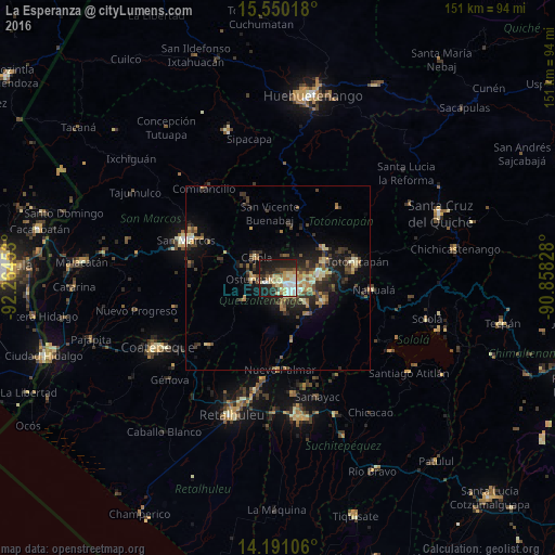
Analysis of La Esperanza night lights 2016
Square area 10x10 km:
 7.44%
7.44%90-99
13.84%80-89
10.33%70-79
5.37%60-69
4.34%50-59
3.31%40-49
4.75%30-39
6.2%20-29
17.77%10-19
26.24%0-9
0.41%Square area 50x50 km:
0.43%90-99
1.3%80-89
1.51%70-79
1.14%60-69
1.46%50-59
0.98%40-49
1.86%30-39
2.41%20-29
3.24%10-19
6.85%0-9
78.83%Clear (daylight) street map image can be seen on geolist.org.
Map coordinates:
15° 33' 0.6" North, 92° 15' 52.3" West
14° 52' 18.1" North, 91° 33' 41" West
14° 11' 27.8" North, 90° 51' 29.8" West
Some cities around La Esperanza sort by population:
• Quetzaltenango
6.2 km =3.9 mi,  131°
131°
• Ostuncalco
6.5 km =4 mi,  267°
267°
• San Andrés Xecul
9.2 km =5.7 mi,  66°
66°
• Salcajá
11.3 km =7 mi,  85°
85°
• Almolonga
9.5 km =5.9 mi, 130°
• Concepción Chiquirichapa
6.9 km =4.3 mi,  254°
254°
• San Miguel Sigüilá
6.3 km =3.9 mi,  294°
294°
• San Mateo
3.4 km =2.1 mi,  243°
243°
3594703 (p: 16,461)
Sources (retrieved 2019-11-25):
» Earth at Night: Flat Maps 2012, 2016