San Carlos Sija night lights from space
Night Light of San Carlos Sija (Quetzaltenango) from space (Guatemala) Src. Average luminocity for 10x10km area is 3.0847% and for 50x50km: 9.0608%.
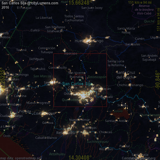
Analysis of San Carlos Sija night lights 2016
Square area 10x10 km:
 0%
0%90-99
0%80-89
0%70-79
0%60-69
0.83%50-59
0%40-49
0.83%30-39
1.65%20-29
0.62%10-19
1.86%0-9
94.21%Square area 50x50 km:
0.41%90-99
1.25%80-89
1.44%70-79
1.04%60-69
1.42%50-59
0.93%40-49
1.75%30-39
2.32%20-29
3.12%10-19
6.66%0-9
79.67%Clear (daylight) street map image can be seen on geolist.org.
Map coordinates:
15° 39' 44.9" North, 92° 15' 8.1" West
14° 59' 3.7" North, 91° 32' 56.8" West
14° 18' 14.7" North, 90° 50' 45.6" West
Some cities around San Carlos Sija sort by population:
• San Francisco El Alto
12.2 km =7.6 mi,  111°
111°
• Ostuncalco
15 km =9.3 mi,  211°
211°
• La Esperanza
12.6 km =7.8 mi,  186°
186°
• San Andrés Xecul
11.3 km =7 mi,  141°
141°
• Cabricán
14.6 km =9.1 mi,  313°
313°
• Huitán
12.1 km =7.5 mi, 306°
• San Miguel Sigüilá
12.1 km =7.5 mi,  215°
215°
• San Mateo
14.7 km =9.1 mi,  197°
197°
3590347 (p: 6,831)
Sources (retrieved 2019-11-25):
» Earth at Night: Flat Maps 2012, 2016