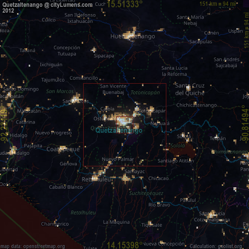
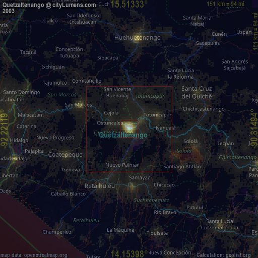
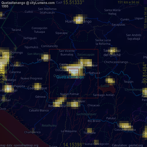
Quetzaltenango night lights from space
Night Light of Quetzaltenango from space (Guatemala) Src. Average luminocity for 10x10km area is 62.8967% and for 50x50km: 9.131%.
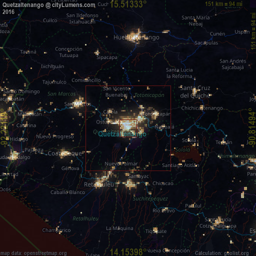
Analysis of Quetzaltenango night lights 2016
Square area 10x10 km:
 7.23%
7.23%90-99
18.39%80-89
14.05%70-79
8.26%60-69
13.84%50-59
4.34%40-49
4.13%30-39
6.61%20-29
12.4%10-19
10.74%0-9
0%Square area 50x50 km:
0.37%90-99
1.19%80-89
1.45%70-79
1.04%60-69
1.46%50-59
1.07%40-49
1.65%30-39
2.27%20-29
3.09%10-19
6.34%0-9
80.07%Clear (daylight) street map image can be seen on geolist.org.
Map coordinates:
15° 30' 48" North, 92° 13' 16.3" West
14° 50' 5" North, 91° 31' 5" West
14° 9' 14.3" North, 90° 48' 53.8" West
Some cities around Quetzaltenango sort by population:
• Cantel
7.2 km =4.5 mi,  110°
110°
• La Esperanza
6.2 km =3.9 mi,  311°
311°
• San Andrés Xecul
8.7 km =5.4 mi,  25°
25°
• Salcajá
8.2 km =5.1 mi,  52°
52°
• Almolonga
3.3 km =2.1 mi,  129°
129°
• Zunil
6.7 km =4.2 mi,  146°
146°
• Concepción Chiquirichapa
11.6 km =7.2 mi,  281°
281°
• San Mateo
8.2 km =5.1 mi,  288°
288°
3590979 (p: 132,230)
Sources (retrieved 2019-11-25):
» NASA, Earths city lights 1995
» NASA city lights 2003
» Earth at Night: Flat Maps 2012, 2016