Sacapulas night lights from space
Night Light of Sacapulas (Quiché) from space (Guatemala) Src. Average luminocity for 10x10km area is 0.5558% and for 50x50km: 0.3177%.
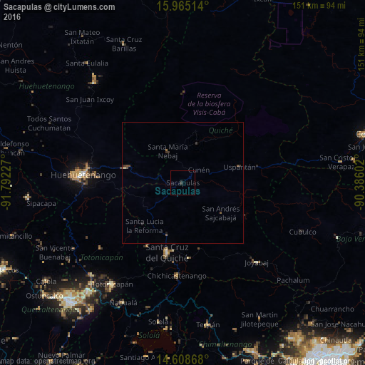
Analysis of Sacapulas night lights 2016
Square area 10x10 km:
 0%
0%90-99
0%80-89
0%70-79
0%60-69
0%50-59
0%40-49
0%30-39
1.03%20-29
0.62%10-19
0%0-9
98.35%Square area 50x50 km:
0%90-99
0%80-89
0.04%70-79
0.02%60-69
0.03%50-59
0.12%40-49
0.11%30-39
0.21%20-29
0.06%10-19
0.03%0-9
99.37%Clear (daylight) street map image can be seen on geolist.org.
Map coordinates:
15° 57' 54.5" North, 91° 47' 32.2" West
15° 17' 16.8" North, 91° 5' 20.9" West
14° 36' 31.2" North, 90° 23' 9.7" West
Some cities around Sacapulas sort by population:
• Chichicastenango
38.4 km =23.9 mi,  183°
183°
• Santa Cruz del Quiché
29.3 km =18.2 mi,  192°
192°
• Nebaj
14.5 km =9 mi,  334°
334°
• Chajul
22.7 km =14.1 mi,  14°
14°
• San Juan Cotzal
17.2 km =10.7 mi,  19°
19°
• Zacualpa
36.8 km =22.9 mi,  142°
142°
• Cunén
8.5 km =5.3 mi,  50°
50°
• Aguacatán
24.6 km =15.3 mi,  284°
284°
3590690 (p: 12,088)
Sources (retrieved 2019-11-25):
» Earth at Night: Flat Maps 2012, 2016