Cunén night lights from space
Night Light of Cunén (Quiché) from space (Guatemala) Src. Average luminocity for 10x10km area is 0% and for 50x50km: 0.1664%.
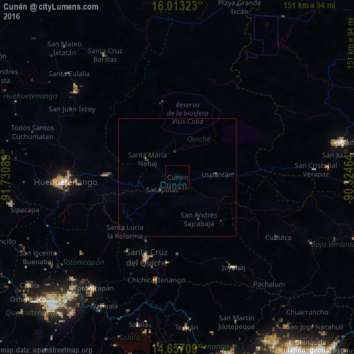
Analysis of Cunén night lights 2016
Square area 10x10 km:
 0%
0%90-99
0%80-89
0%70-79
0%60-69
0%50-59
0%40-49
0%30-39
0%20-29
0%10-19
0%0-9
100%Square area 50x50 km:
0%90-99
0%80-89
0%70-79
0%60-69
0.03%50-59
0.04%40-49
0.03%30-39
0.18%20-29
0.13%10-19
0%0-9
99.6%Clear (daylight) street map image can be seen on geolist.org.
Map coordinates:
16° 0' 47.6" North, 91° 43' 51.2" West
15° 20' 10.5" North, 91° 1' 39.9" West
14° 39' 25.5" North, 90° 19' 28.7" West
Some cities around Cunén sort by population:
• Chichicastenango
44.6 km =27.7 mi,  191°
191°
• Santa Cruz del Quiché
36.4 km =22.6 mi,  200°
200°
• Nebaj
14.9 km =9.3 mi,  301°
301°
• Sacapulas
8.5 km =5.3 mi,  230°
230°
• Chajul
16.6 km =10.3 mi,  357°
357°
• San Juan Cotzal
10.9 km =6.8 mi, 356°
• Zacualpa
38 km =23.6 mi,  154°
154°
• Aguacatán
30.4 km =18.9 mi,  271°
271°
3597772 (p: 8,400)
Sources (retrieved 2019-11-25):
» Earth at Night: Flat Maps 2012, 2016