Huitán night lights from space
Night Light of Huitán (Quetzaltenango) from space (Guatemala) Src. Average luminocity for 10x10km area is 2.2521% and for 50x50km: 8.0289%.
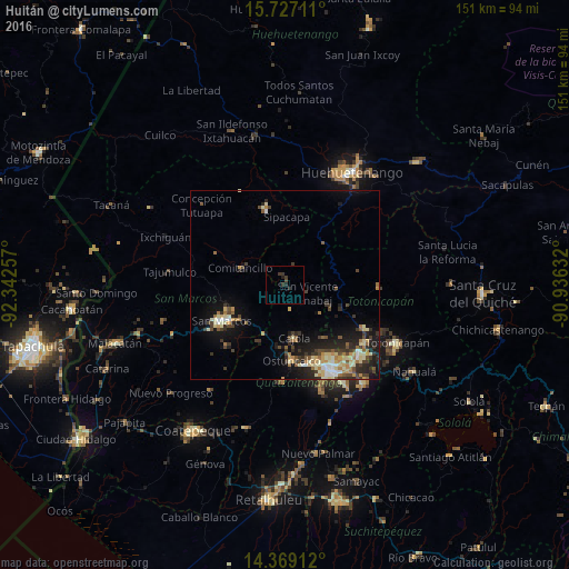
Analysis of Huitán night lights 2016
Square area 10x10 km:
 0%
0%90-99
0%80-89
0%70-79
0%60-69
0%50-59
0%40-49
0.83%30-39
3.31%20-29
1.86%10-19
0.62%0-9
93.39%Square area 50x50 km:
0.5%90-99
1.38%80-89
1.31%70-79
0.87%60-69
1.17%50-59
0.81%40-49
1.37%30-39
1.82%20-29
2.43%10-19
5.44%0-9
82.9%Clear (daylight) street map image can be seen on geolist.org.
Map coordinates:
15° 43' 37.6" North, 92° 20' 33.3" West
15° 2' 57.1" North, 91° 38' 22" West
14° 22' 8.8" North, 90° 56' 10.8" West
Some cities around Huitán sort by population:
• San Pedro Sacatepéquez
15.9 km =9.9 mi,  235°
235°
• Ostuncalco
20.1 km =12.5 mi,  174°
174°
• San Marcos
19.2 km =11.9 mi, 240°
• Comitancillo
12.7 km =7.9 mi,  290°
290°
• La Esperanza
21.4 km =13.3 mi,  156°
156°
• Cabricán
3 km =1.9 mi,  342°
342°
• San Miguel Sigüilá
17.3 km =10.7 mi, 171°
• San Carlos Sija
12.1 km =7.5 mi,  126°
126°
3595406 (p: 9,958)
Sources (retrieved 2019-11-25):
» Earth at Night: Flat Maps 2012, 2016