Ostuncalco night lights from space
Night Light of Ostuncalco (Quetzaltenango) from space (Guatemala) Src. Average luminocity for 10x10km area is 21.4814% and for 50x50km: 9.8627%.
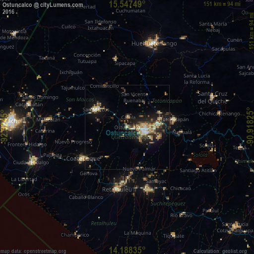
Analysis of Ostuncalco night lights 2016
Square area 10x10 km:
 1.03%
1.03%90-99
2.07%80-89
1.65%70-79
1.65%60-69
3.1%50-59
3.93%40-49
3.51%30-39
5.37%20-29
9.3%10-19
30.99%0-9
37.4%Square area 50x50 km:
0.48%90-99
1.45%80-89
1.51%70-79
1.11%60-69
1.54%50-59
0.98%40-49
1.69%30-39
2.51%20-29
3.19%10-19
7.58%0-9
77.97%Clear (daylight) street map image can be seen on geolist.org.
Map coordinates:
15° 32' 51" North, 92° 19' 28.2" West
14° 52' 8.4" North, 91° 37' 16.9" West
14° 11' 18.1" North, 90° 55' 5.7" West
Some cities around Ostuncalco sort by population:
• Quetzaltenango
11.7 km =7.3 mi,  108°
108°
• La Esperanza
6.5 km =4 mi,  87°
87°
• San Andrés Xecul
15.4 km =9.6 mi,  74°
74°
• Almolonga
14.8 km =9.2 mi, 113°
• Concepción Chiquirichapa
1.6 km =1 mi,  188°
188°
• San Miguel Sigüilá
3 km =1.9 mi,  13°
13°
• San Carlos Sija
15 km =9.3 mi,  31°
31°
• San Mateo
3.6 km =2.2 mi, 109°
3591997 (p: 28,894)
Sources (retrieved 2019-11-25):
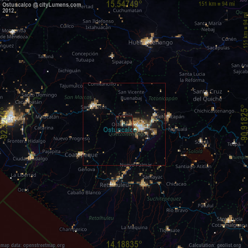
» Earth at Night: Flat Maps 2012, 2016