Comitancillo night lights from space
Night Light of Comitancillo (San Marcos) from space (Guatemala) Src. Average luminocity for 10x10km area is 1.9959% and for 50x50km: 4.1128%.
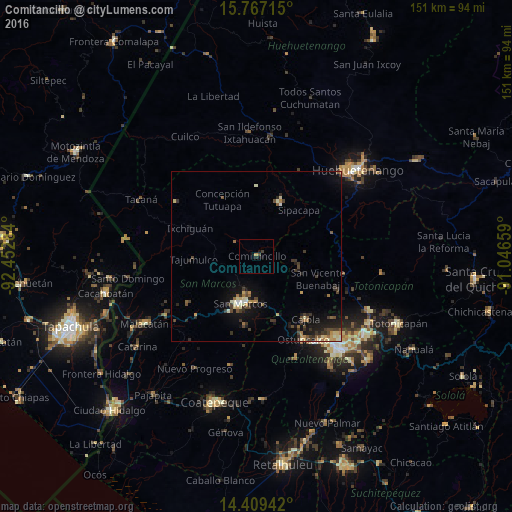
Analysis of Comitancillo night lights 2016
Square area 10x10 km:
 0%
0%90-99
0%80-89
0%70-79
0.83%60-69
0%50-59
0%40-49
0.83%30-39
0.83%20-29
0.83%10-19
1.86%0-9
94.83%Square area 50x50 km:
0.12%90-99
0.57%80-89
0.53%70-79
0.48%60-69
0.5%50-59
0.5%40-49
0.94%30-39
1.14%20-29
1.03%10-19
3.3%0-9
90.9%Clear (daylight) street map image can be seen on geolist.org.
Map coordinates:
15° 46' 1.7" North, 92° 27' 10.2" West
15° 5' 21.7" North, 91° 44' 59" West
14° 24' 33.9" North, 91° 2' 47.7" West
Some cities around Comitancillo sort by population:
• San Pedro Sacatepéquez
13.5 km =8.4 mi,  185°
185°
• Ostuncalco
28.1 km =17.5 mi,  150°
150°
• San Marcos
14.8 km =9.2 mi,  198°
198°
• Cabricán
11 km =6.8 mi,  98°
98°
• Huitán
12.7 km =7.9 mi,  110°
110°
• San Cristóbal Cucho
20.8 km =12.9 mi, 189°
• San Miguel Sigüilá
26 km =16.2 mi, 146°
• San Carlos Sija
24.5 km =15.2 mi,  118°
118°
3598025 (p: 19,669)
Sources (retrieved 2019-11-25):
» Earth at Night: Flat Maps 2012, 2016