Guastatoya night lights from space
Night Light of Guastatoya (El Progreso) from space (Guatemala) Src. Average luminocity for 10x10km area is 4.4132% and for 50x50km: 1.1821%.
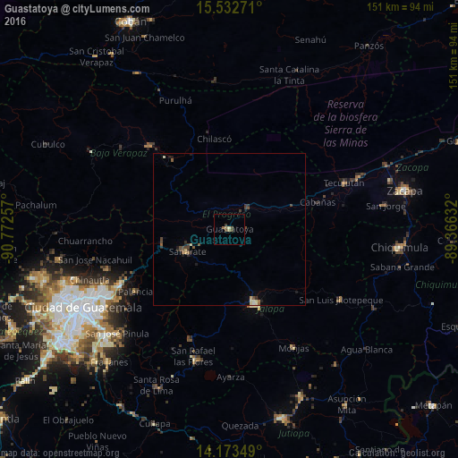
Analysis of Guastatoya night lights 2016
Square area 10x10 km:
 0%
0%90-99
0%80-89
0.83%70-79
0%60-69
2.07%50-59
0.62%40-49
2.07%30-39
1.03%20-29
0%10-19
0%0-9
93.39%Square area 50x50 km:
0%90-99
0.08%80-89
0.25%70-79
0.07%60-69
0.14%50-59
0.28%40-49
0.36%30-39
0.36%20-29
0.22%10-19
0.27%0-9
97.97%Clear (daylight) street map image can be seen on geolist.org.
Map coordinates:
15° 31' 57.8" North, 90° 46' 21.3" West
14° 51' 15" North, 90° 4' 10" West
14° 10' 24.6" North, 89° 21' 58.8" West
Some cities around Guastatoya sort by population:
• Jalapa
25.9 km =16.1 mi,  160°
160°
• Salamá
38.4 km =23.9 mi,  315°
315°
• Palencia
37.3 km =23.2 mi,  236°
236°
• Sanarate
15.7 km =9.8 mi, 242°
• San Agustín Acasaguastlán
15.3 km =9.5 mi,  46°
46°
• San Jerónimo
29.4 km =18.3 mi, 321°
• San Antonio La Paz
25.5 km =15.8 mi,  245°
245°
• Mataquescuintla
38.2 km =23.7 mi,  198°
198°
3596421 (p: 13,467)
Sources (retrieved 2019-11-25):
» Earth at Night: Flat Maps 2012, 2016