San Jerónimo night lights from space
Night Light of San Jerónimo (Baja Verapaz) from space (Guatemala) Src. Average luminocity for 10x10km area is 1.7252% and for 50x50km: 0.5434%.
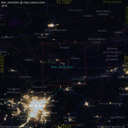
Analysis of San Jerónimo night lights 2016
Square area 10x10 km:
 0%
0%90-99
0%80-89
0.83%70-79
0%60-69
0%50-59
0.83%40-49
0%30-39
0%20-29
0.21%10-19
1.45%0-9
96.69%Square area 50x50 km:
0%90-99
0%80-89
0.07%70-79
0%60-69
0.18%50-59
0.08%40-49
0.21%30-39
0.29%20-29
0.1%10-19
0.17%0-9
98.9%Clear (daylight) street map image can be seen on geolist.org.
Map coordinates:
15° 44' 17.5" North, 90° 56' 37.1" West
15° 3' 37.2" North, 90° 14' 25.8" West
14° 22' 49" North, 89° 32' 14.6" West
Some cities around San Jerónimo sort by population:
• Salamá
9.6 km =6 mi,  299°
299°
• Sanarate
30.6 km =19 mi,  171°
171°
• San Miguel Chicaj
17 km =10.6 mi,  283°
283°
• Guastatoya
29.4 km =18.3 mi,  141°
141°
• Rabinal
27.2 km =16.9 mi, 275°
• San Agustín Acasaguastlán
31.9 km =19.8 mi,  112°
112°
• Tactic
31.6 km =19.6 mi,  337°
337°
• Purulhá
23.4 km =14.5 mi,  10°
10°
3590114 (p: 8,093)
Sources (retrieved 2019-11-25):
» Earth at Night: Flat Maps 2012, 2016