Palín night lights from space
Night Light of Palín (Escuintla) from space (Guatemala) Src. Average luminocity for 10x10km area is 21.7359% and for 50x50km: 19.5112%.
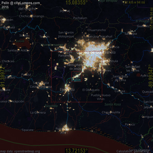
Analysis of Palín night lights 2016
Square area 10x10 km:
 1.73%
1.73%90-99
3.9%80-89
4.98%70-79
2.81%60-69
1.73%50-59
1.73%40-49
1.52%30-39
2.38%20-29
3.03%10-19
21%0-9
55.19%Square area 50x50 km:
3.54%90-99
4.22%80-89
3.1%70-79
2.27%60-69
2.5%50-59
2.26%40-49
2.09%30-39
2.02%20-29
2.54%10-19
10.16%0-9
65.3%Clear (daylight) street map image can be seen on geolist.org.
Map coordinates:
15° 5' 0.8" North, 91° 23' 59" West
14° 24' 12.9" North, 90° 41' 47.7" West
13° 43' 17.5" North, 89° 59' 36.5" West
Some cities around Palín sort by population:
• Escuintla
14.5 km =9 mi,  220°
220°
• Amatitlán
10.6 km =6.6 mi,  38°
38°
• Ciudad Vieja
15.2 km =9.4 mi,  331°
331°
• Alotenango
14.7 km =9.1 mi,  305°
305°
• Santa María de Jesús
10.2 km =6.3 mi,  351°
351°
• San Miguel Dueñas
17.2 km =10.7 mi,  320°
320°
• San Vicente Pacaya
6.6 km =4.1 mi,  79°
79°
• Magdalena Milpas Altas
16.2 km =10.1 mi,  8°
8°
3591833 (p: 31,329)
Sources (retrieved 2019-11-25):
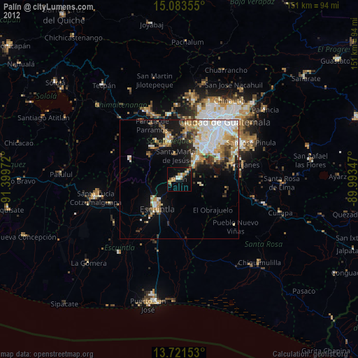
» Earth at Night: Flat Maps 2012, 2016