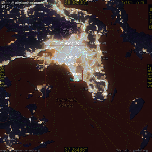
Voúla night lights from space
Night Light of Voúla (Attica) from space (Greece) Src. Average luminocity for 10x10km area is 64.9048% and for 50x50km: 39.4236%.
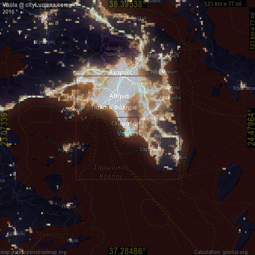
Analysis of Voúla night lights 2016
Square area 10x10 km:
 17.69%
90-99
17.52%80-89
8.5%70-79
3.74%60-69
7.99%50-59
9.01%40-49
9.35%30-39
5.95%20-29
11.73%10-19
7.14%0-9
1.36%Square area 50x50 km:
11.48%90-99
8.55%80-89
3.95%70-79
5.32%60-69
6.19%50-59
4.04%40-49
4.11%30-39
4%20-29
6.3%10-19
7.59%0-9
38.46%Clear (daylight) street map image can be seen on geolist.org.
Map coordinates:
38° 23' 43.4" North, 23° 4' 24.2" East
37° 50' 32" North, 23° 46' 35.4" East
37° 17' 5.5" North, 24° 28' 46.7" East
Some cities around Voúla sort by population:
• Glyfáda
2.8 km =1.7 mi,  324°
324°
• Ilioúpoli
10 km =6.2 mi,  355°
355°
• Agios Dimitrios
10.8 km =6.7 mi,  339°
339°
• Álimos
8.9 km =5.5 mi,  328°
328°
• Argyroúpoli
7.4 km =4.6 mi, 342°
• Koropí
10.5 km =6.5 mi,  53°
53°
• Ellinikó
6 km =3.7 mi, 331°
• Vári
2.5 km =1.6 mi,  113°
113°
251780 (p: 28,364)
Sources (retrieved 2019-11-25):
» Earth at Night: Flat Maps 2012, 2016