Glyfáda night lights from space
Night Light of Glyfáda (Attica) from space (Greece) Src. Average luminocity for 10x10km area is 65.638% and for 50x50km: 43.0839%.
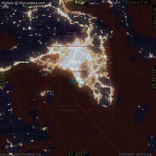

Analysis of Glyfáda night lights 2016
Square area 10x10 km:
 21.59%
90-99
21.1%80-89
2.27%70-79
3.08%60-69
5.19%50-59
9.42%40-49
11.53%30-39
5.84%20-29
10.88%10-19
6.82%0-9
2.27%Square area 50x50 km:
12.72%90-99
9.42%80-89
4.43%70-79
5.96%60-69
6.65%50-59
4.23%40-49
4.27%30-39
4.51%20-29
6.8%10-19
7.34%0-9
33.66%Clear (daylight) street map image can be seen on geolist.org.
Map coordinates:
38° 24' 57.2" North, 23° 3' 17.6" East
37° 51' 46.4" North, 23° 45' 28.9" East
37° 18' 20.5" North, 24° 27' 40.1" East
Some cities around Glyfáda sort by population:
• Ilioúpoli
7.7 km =4.8 mi,  6°
6°
• Agios Dimitrios
8.1 km =5 mi,  344°
344°
• Palaió Fáliro
8.8 km =5.5 mi,  325°
325°
• Álimos
6.1 km =3.8 mi, 330°
• Argyroúpoli
4.8 km =3 mi,  351°
351°
• Voúla
2.8 km =1.7 mi,  144°
144°
• Ellinikó
3.3 km =2.1 mi, 337°
• Vári
5.2 km =3.2 mi,  129°
129°
262036 (p: 87,305)
Sources (retrieved 2019-11-25):
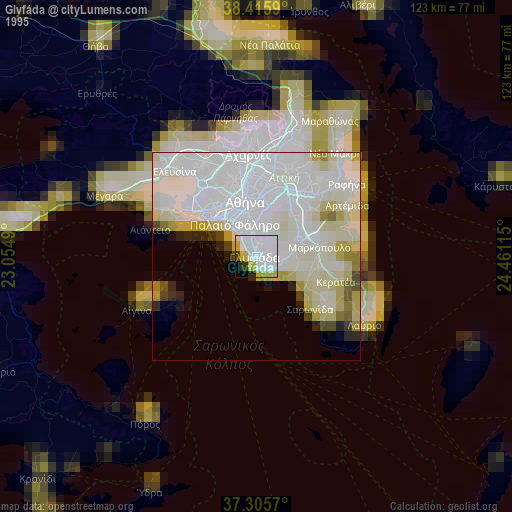
» NASA, Earths city lights 1995
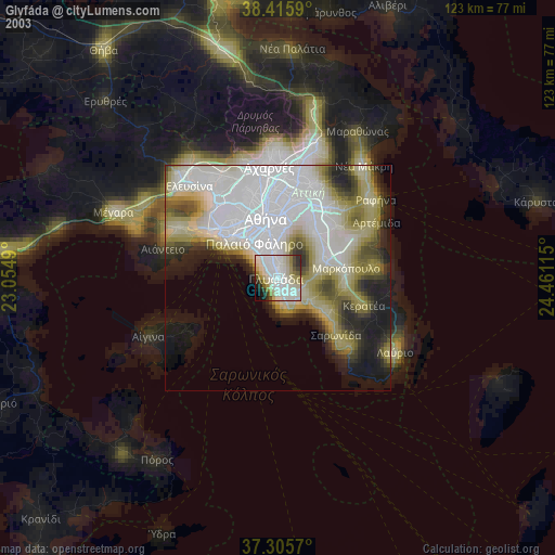
» NASA city lights 2003
» Earth at Night: Flat Maps 2012, 2016