Koropí night lights from space
Night Light of Koropí (Attica) from space (Greece) Src. Average luminocity for 10x10km area is 71.1185% and for 50x50km: 42.739%.
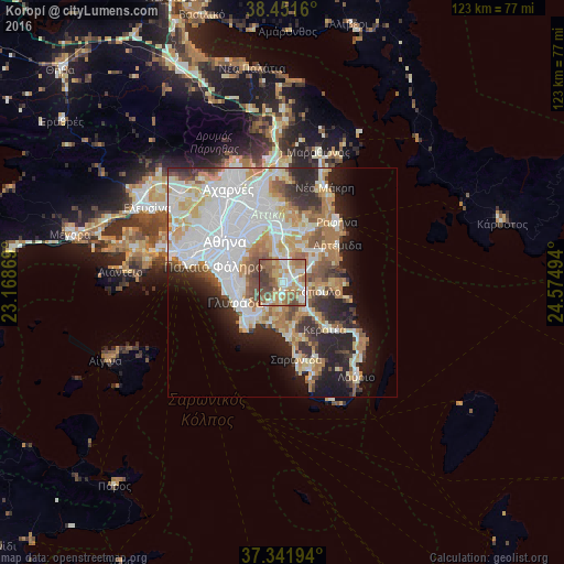
Analysis of Koropí night lights 2016
Square area 10x10 km:
 10.06%
90-99
16.4%80-89
10.39%70-79
12.66%60-69
18.34%50-59
16.4%40-49
9.09%30-39
6.66%20-29
0%10-19
0%0-9
0%Square area 50x50 km:
12.89%90-99
9.8%80-89
4.32%70-79
5.83%60-69
6.09%50-59
3.9%40-49
3.53%30-39
3.84%20-29
7.55%10-19
8.63%0-9
33.62%Clear (daylight) street map image can be seen on geolist.org.
Map coordinates:
38° 27' 5.8" North, 23° 10' 7.3" East
37° 53' 55.9" North, 23° 52' 18.5" East
37° 20' 31" North, 24° 34' 29.8" East
Some cities around Koropí sort by population:
• Ilioúpoli
9.8 km =6.1 mi,  291°
291°
• Voúla
10.5 km =6.5 mi,  233°
233°
• Vári
9.5 km =5.9 mi,  219°
219°
• Paianía
6.5 km =4 mi,  346°
346°
• Kalývia Thorikoú
8.1 km =5 mi,  144°
144°
• Markópoulo
5.7 km =3.5 mi,  107°
107°
• Spáta
7.9 km =4.9 mi,  28°
28°
• Leondárion
9.9 km =6.2 mi, 351°
259251 (p: 19,164)
Sources (retrieved 2019-11-25):
» Earth at Night: Flat Maps 2012, 2016