Añisoc night lights from space
Night Light of Añisoc (Wele-Nzas) from space (Equatorial Guinea) Src. Average luminocity for 10x10km area is 6.0455% and for 50x50km: 1.0747%.
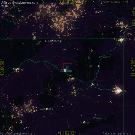
Analysis of Añisoc night lights 2016
Square area 10x10 km:
 0.43%
0.43%90-99
0.43%80-89
0%70-79
0.43%60-69
4.33%50-59
1.73%40-49
0.87%30-39
0%20-29
0%10-19
0.87%0-9
90.91%Square area 50x50 km:
0.02%90-99
0.02%80-89
0.01%70-79
0.1%60-69
0.31%50-59
0.35%40-49
0.26%30-39
0.23%20-29
0.59%10-19
0.28%0-9
97.84%Clear (daylight) street map image can be seen on geolist.org.
Map coordinates:
2° 34' 6.2" North, 10° 3' 56.9" East
1° 51' 56.9" North, 10° 46' 8.1" East
1° 9' 46.5" North, 11° 28' 19.4" East
Some cities around Añisoc sort by population:
• Oyem, GA
94.8 km =58.9 mi,  108°
108°
• Ebebiyin
70.5 km =43.8 mi,  63°
63°
• Aconibe
66 km =41 mi,  163°
163°
• Bitam, GA
84.6 km =52.6 mi,  73°
73°
• Ambam, CM
81.1 km =50.4 mi,  44°
44°
• Evinayong
53.5 km =33.2 mi,  206°
206°
• Mongomo
66.1 km =41.1 mi, 113°
• Mikomeseng
34.7 km =21.6 mi,  330°
330°
2310309 (p: 10,191)
Sources (retrieved 2019-11-25):
» Earth at Night: Flat Maps 2012, 2016