Evinayong night lights from space
Night Light of Evinayong (Centro Sur) from space (Equatorial Guinea) Src. Average luminocity for 10x10km area is 5.7468% and for 50x50km: 2.0846%.
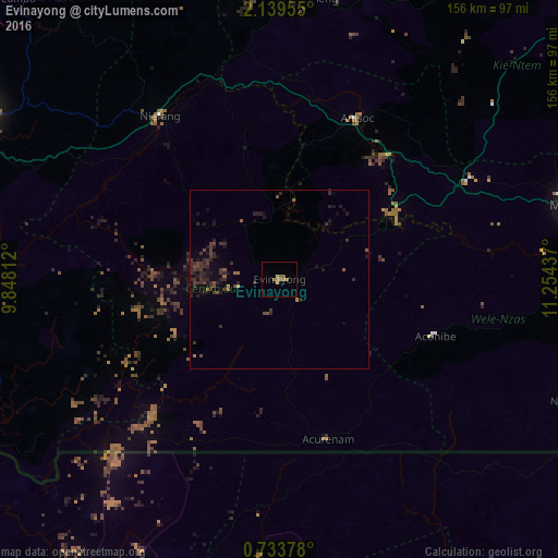
Analysis of Evinayong night lights 2016
Square area 10x10 km:
 0%
0%90-99
0%80-89
0%70-79
1.73%60-69
2.6%50-59
3.46%40-49
0%30-39
0%20-29
0%10-19
0%0-9
92.21%Square area 50x50 km:
0%90-99
0%80-89
0%70-79
0.14%60-69
0.34%50-59
0.42%40-49
0.62%30-39
1.13%20-29
1.29%10-19
1.27%0-9
94.79%Clear (daylight) street map image can be seen on geolist.org.
Map coordinates:
2° 8' 22.4" North, 9° 50' 53.2" East
1° 26' 12.4" North, 10° 33' 4.5" East
0° 44' 1.6" North, 11° 15' 15.7" East
Some cities around Evinayong sort by population:
• Bata
99.4 km =61.8 mi,  298°
298°
• Oyem, GA
115.7 km =71.9 mi,  81°
81°
• Ebebiyin
117.9 km =73.3 mi,  47°
47°
• Aconibe
45.6 km =28.3 mi,  109°
109°
• Bitam, GA
127.2 km =79 mi,  56°
56°
• Añisoc
53.5 km =33.2 mi,  26°
26°
• Mongomo
87.3 km =54.2 mi, 75°
• Mikomeseng
78.1 km =48.5 mi,  5°
5°
2308994 (p: 8,462)
Sources (retrieved 2019-11-25):
» Earth at Night: Flat Maps 2012, 2016