Akom II night lights from space
Night Light of Akom II (South) from space (Cameroon) Src. Average luminocity for 10x10km area is 0.039% and for 50x50km: 3.2144%.
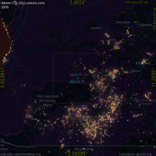
Analysis of Akom II night lights 2016
Square area 10x10 km:
 0%
0%90-99
0%80-89
0%70-79
0%60-69
0%50-59
0%40-49
0%30-39
0%20-29
0%10-19
0%0-9
100%Square area 50x50 km:
0%90-99
0%80-89
0%70-79
0.02%60-69
0.24%50-59
0.75%40-49
1.28%30-39
1.47%20-29
2.32%10-19
2.78%0-9
91.14%Clear (daylight) street map image can be seen on geolist.org.
Map coordinates:
3° 29' 7.4" North, 9° 51' 48.7" East
2° 46' 60" North, 10° 34' 0" East
2° 4' 51" North, 11° 16' 11.3" East
Some cities around Akom II sort by population:
• Ébolowa
66.1 km =41.1 mi,  78°
78°
• Kribi
75.2 km =46.7 mi,  283°
283°
• Ebebiyin, GQ
110.6 km =68.7 mi,  129°
129°
• Lolodorf
53.3 km =33.1 mi,  20°
20°
• Eséka
98.9 km =61.5 mi,  12°
12°
• Añisoc, GQ
104.5 km =64.9 mi,  167°
167°
• Ambam
91.2 km =56.7 mi,  119°
119°
• Mikomeseng, GQ
72.2 km =44.9 mi,  175°
175°
2235814 (p: 9,709)
Sources (retrieved 2019-11-25):
» Earth at Night: Flat Maps 2012, 2016