Tafo night lights from space
Night Light of Tafo (Ashanti) from space (Ghana) Src. Average luminocity for 10x10km area is 89.5065% and for 50x50km: 24.6797%.
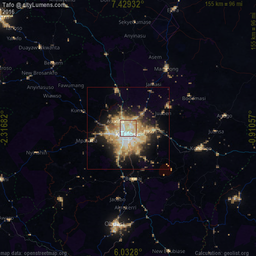
Analysis of Tafo night lights 2016
Square area 10x10 km:
 24.46%
90-99
23.81%80-89
34.63%70-79
15.8%60-69
1.3%50-59
0%40-49
0%30-39
0%20-29
0%10-19
0%0-9
0%Square area 50x50 km:
2.27%90-99
2.92%80-89
6.17%70-79
5.06%60-69
3.7%50-59
3.08%40-49
4.27%30-39
3.19%20-29
4.86%10-19
9.05%0-9
55.42%Clear (daylight) street map image can be seen on geolist.org.
Map coordinates:
7° 25' 45.6" North, 2° 19' 0.6" West
6° 43' 53.6" North, 1° 36' 49.3" West
6° 1' 58.1" North, 0° 54' 38.1" West
Some cities around Tafo sort by population:
• Kumasi
4.9 km =3 mi,  193°
193°
• Obuase
59.2 km =36.8 mi, 185°
• Ejura
78.1 km =48.5 mi,  21°
21°
• Mampong
43.7 km =27.2 mi,  32°
32°
• Konongo
45.7 km =28.4 mi,  106°
106°
• Agogo
59.2 km =36.8 mi,  82°
82°
• Duayaw-Nkwanta
72.8 km =45.2 mi,  312°
312°
• Bechem
60.4 km =37.5 mi, 311°
2294938 (p: 50,457)
Sources (retrieved 2019-11-25):
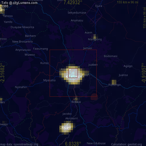
» NASA, Earths city lights 1995
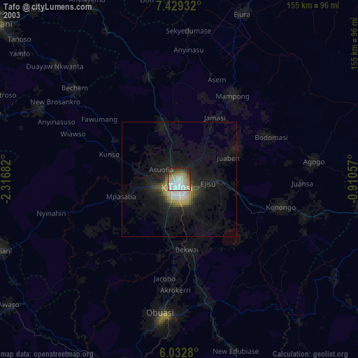
» NASA city lights 2003
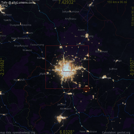
» Earth at Night: Flat Maps 2012, 2016