Agogo night lights from space
Night Light of Agogo (Ashanti) from space (Ghana) Src. Average luminocity for 10x10km area is 5.0931% and for 50x50km: 1.6006%.
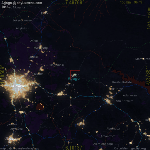
Analysis of Agogo night lights 2016
Square area 10x10 km:
100  0%
0%
90-99 0%
80-89 1.73%
70-79 0%
60-69 0.87%
50-59 0.87%
40-49 1.73%
30-39 1.95%
20-29 1.52%
10-19 1.08%
0-9 90.26%
0%90-99
0%80-89
1.73%70-79
0%60-69
0.87%50-59
0.87%40-49
1.73%30-39
1.95%20-29
1.52%10-19
1.08%0-9
90.26%Square area 50x50 km:
100 0%
90-99 0.03%
80-89 0.31%
70-79 0.25%
60-69 0.15%
50-59 0.29%
40-49 0.62%
30-39 0.45%
20-29 0.37%
10-19 0.29%
0-9 97.23%
0%90-99
0.03%80-89
0.31%70-79
0.25%60-69
0.15%50-59
0.29%40-49
0.62%30-39
0.45%20-29
0.37%10-19
0.29%0-9
97.23%Clear (daylight) street map image can be seen on geolist.org.
Map coordinates:
7° 29' 51.7" North, 1° 47' 6.2" West
6° 48' 0.1" North, 1° 4' 54.9" West
6° 6' 4.9" North, 0° 22' 43.7" West
Some cities around Agogo sort by population:
• Kumasi
61.2 km =38 mi,  258°
258°
• Ejura
71.8 km =44.6 mi,  335°
335°
• Tafo
59.2 km =36.8 mi, 262°
• Mampong
45.7 km =28.4 mi,  309°
309°
• Konongo
25.2 km =15.7 mi,  216°
216°
• Begoro
90.4 km =56.2 mi,  120°
120°
• Akwatia
89.7 km =55.7 mi,  160°
160°
• Mpraeso
44.7 km =27.8 mi, 120°
2305537 (p: 31,554)
Sources (retrieved 2019-11-25):
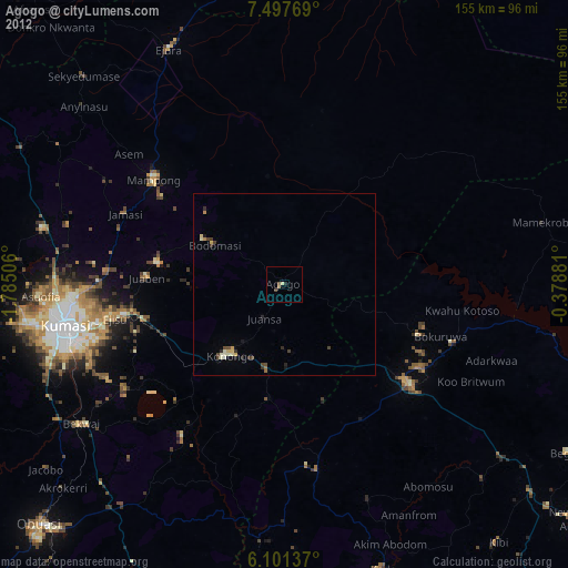
» Earth at Night: Flat Maps 2012, 2016