Konongo night lights from space
Night Light of Konongo (Ashanti) from space (Ghana) Src. Average luminocity for 10x10km area is 19.0736% and for 50x50km: 2.2777%.
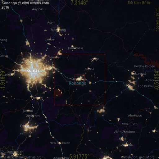
Analysis of Konongo night lights 2016
Square area 10x10 km:
100  0%
0%
90-99 0.43%
80-89 5.63%
70-79 3.9%
60-69 0.87%
50-59 3.9%
40-49 6.06%
30-39 3.25%
20-29 2.6%
10-19 3.25%
0-9 70.13%
0%90-99
0.43%80-89
5.63%70-79
3.9%60-69
0.87%50-59
3.9%40-49
6.06%30-39
3.25%20-29
2.6%10-19
3.25%0-9
70.13%Square area 50x50 km:
100 0%
90-99 0.02%
80-89 0.32%
70-79 0.4%
60-69 0.22%
50-59 0.39%
40-49 0.74%
30-39 0.64%
20-29 0.66%
10-19 0.85%
0-9 95.77%
0%90-99
0.02%80-89
0.32%70-79
0.4%60-69
0.22%50-59
0.39%40-49
0.74%30-39
0.64%20-29
0.66%10-19
0.85%0-9
95.77%Clear (daylight) street map image can be seen on geolist.org.
Map coordinates:
7° 18' 52.6" North, 1° 55' 11.2" West
6° 37' 0" North, 1° 13' 0" West
5° 55' 3.9" North, 0° 30' 48.7" West
Some cities around Konongo sort by population:
• Kumasi
45.7 km =28.4 mi,  280°
280°
• Obuase
67.9 km =42.2 mi,  227°
227°
• Akim Oda
80.9 km =50.3 mi,  161°
161°
• Tafo
45.7 km =28.4 mi,  286°
286°
• Mampong
53.6 km =33.3 mi,  337°
337°
• Agogo
25.2 km =15.7 mi,  36°
36°
• Akwatia
78.4 km =48.7 mi,  144°
144°
• Mpraeso
53.3 km =33.1 mi,  92°
92°
2299349 (p: 41,238)
Sources (retrieved 2019-11-25):
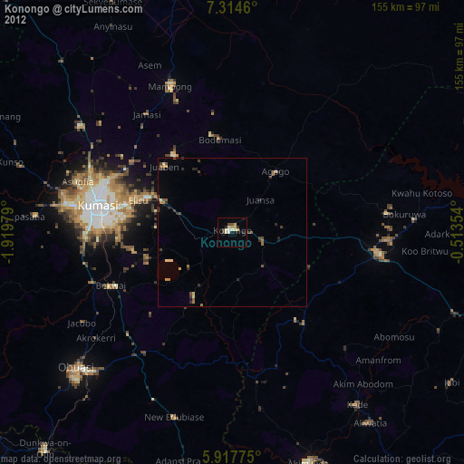
» Earth at Night: Flat Maps 2012, 2016