Kumasi night lights from space
Night Light of Kumasi (Ashanti) from space (Ghana) Src. Average luminocity for 10x10km area is 95.1797% and for 50x50km: 24.2387%.
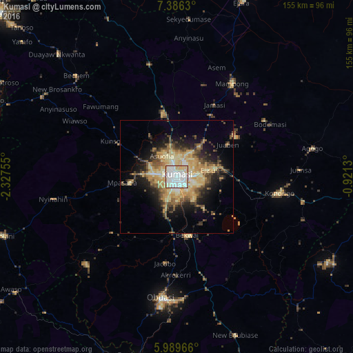
Analysis of Kumasi night lights 2016
Square area 10x10 km:
 47.19%
90-99
29.65%80-89
18.83%70-79
4.33%60-69
0%50-59
0%40-49
0%30-39
0%20-29
0%10-19
0%0-9
0%Square area 50x50 km:
2.27%90-99
2.92%80-89
6.03%70-79
4.89%60-69
3.63%50-59
2.96%40-49
4.14%30-39
3.24%20-29
4.72%10-19
8.97%0-9
56.25%Clear (daylight) street map image can be seen on geolist.org.
Map coordinates:
7° 23' 10.7" North, 2° 19' 39.2" West
6° 41' 18.5" North, 1° 37' 27.9" West
5° 59' 22.8" North, 0° 55' 16.7" West
Some cities around Kumasi sort by population:
• Obuase
54.3 km =33.7 mi,  185°
185°
• Tafo
4.9 km =3 mi,  13°
13°
• Mampong
48.4 km =30.1 mi,  30°
30°
• Konongo
45.7 km =28.4 mi,  100°
100°
• Agogo
61.2 km =38 mi,  78°
78°
• Bibiani
80.7 km =50.1 mi,  251°
251°
• Duayaw-Nkwanta
75.3 km =46.8 mi,  315°
315°
• Bechem
62.9 km =39.1 mi, 315°
2298890 (p: 1,468,609)
Sources (retrieved 2019-11-25):
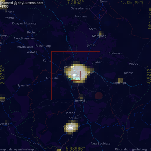
» NASA, Earths city lights 1995
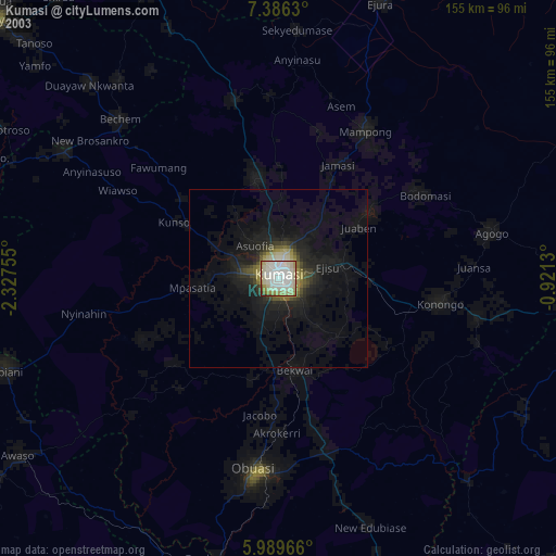
» NASA city lights 2003
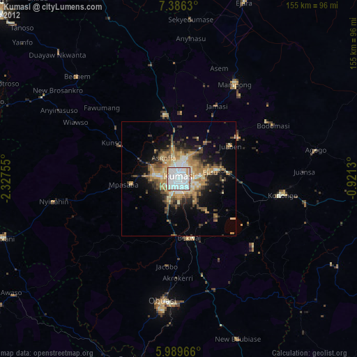
» Earth at Night: Flat Maps 2012, 2016