Bechem night lights from space
Night Light of Bechem (Brong-Ahafo) from space (Ghana) Src. Average luminocity for 10x10km area is 4.9113% and for 50x50km: 0.9103%.
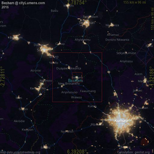
Analysis of Bechem night lights 2016
Square area 10x10 km:
 0%
0%90-99
0%80-89
0%70-79
2.16%60-69
0.43%50-59
0.65%40-49
1.08%30-39
3.03%20-29
1.3%10-19
0%0-9
91.34%Square area 50x50 km:
0%90-99
0%80-89
0.07%70-79
0.19%60-69
0.1%50-59
0.13%40-49
0.29%30-39
0.5%20-29
0.26%10-19
0.34%0-9
98.11%Clear (daylight) street map image can be seen on geolist.org.
Map coordinates:
7° 47' 15.1" North, 2° 43' 41.2" West
7° 5' 25.2" North, 2° 1' 29.9" West
6° 23' 31.5" North, 1° 19' 18.7" West
Some cities around Bechem sort by population:
• Kumasi
62.9 km =39.1 mi,  135°
135°
• Sunyani
43.3 km =26.9 mi,  309°
309°
• Techiman
55.7 km =34.6 mi,  9°
9°
• Berekum
73.7 km =45.8 mi,  303°
303°
• Tafo
60.4 km =37.5 mi,  131°
131°
• Mampong
69 km =42.9 mi,  92°
92°
• Wenchi
72.7 km =45.2 mi,  353°
353°
• Duayaw-Nkwanta
12.5 km =7.8 mi,  318°
318°
2303258 (p: 17,000)
Sources (retrieved 2019-11-25):
» Earth at Night: Flat Maps 2012, 2016