Apam night lights from space
Night Light of Apam (Central) from space (Ghana) Src. Average luminocity for 10x10km area is 5.1798% and for 50x50km: 3.4001%.
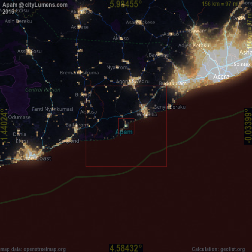
Analysis of Apam night lights 2016
Square area 10x10 km:
100  0%
0%
90-99 0%
80-89 0.83%
70-79 0%
60-69 0.41%
50-59 1.24%
40-49 2.27%
30-39 2.07%
20-29 4.55%
10-19 0.21%
0-9 88.43%
0%90-99
0%80-89
0.83%70-79
0%60-69
0.41%50-59
1.24%40-49
2.27%30-39
2.07%20-29
4.55%10-19
0.21%0-9
88.43%Square area 50x50 km:
100 0.02%
90-99 0.05%
80-89 0.61%
70-79 0.29%
60-69 0.55%
50-59 0.51%
40-49 0.99%
30-39 0.97%
20-29 0.95%
10-19 2.25%
0-9 92.81%
0.02%90-99
0.05%80-89
0.61%70-79
0.29%60-69
0.55%50-59
0.51%40-49
0.99%30-39
0.97%20-29
0.95%10-19
2.25%0-9
92.81%Clear (daylight) street map image can be seen on geolist.org.
Map coordinates:
5° 59' 4.4" North, 1° 26' 24.9" West
5° 17' 5.4" North, 0° 44' 13.6" West
4° 35' 3.6" North, 0° 2' 2.4" West
Some cities around Apam sort by population:
• Cape Coast
59.8 km =37.2 mi,  250°
250°
• Swedru
28.4 km =17.6 mi,  8°
8°
• Gbawe
57.3 km =35.6 mi,  55°
55°
• Winneba
14.6 km =9.1 mi, 59°
• Kasoa
45 km =28 mi,  51°
51°
• Asamankese
64.5 km =40.1 mi, 7°
• Saltpond
36.8 km =22.9 mi,  256°
256°
• Mumford
3.5 km =2.2 mi,  223°
223°
2304389 (p: 20,147)
Sources (retrieved 2019-11-25):
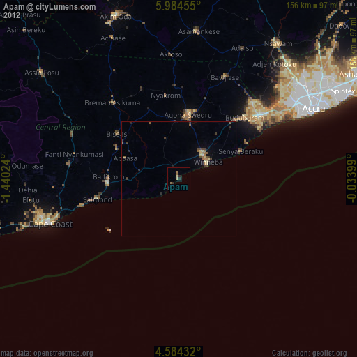
» Earth at Night: Flat Maps 2012, 2016