Saltpond night lights from space
Night Light of Saltpond (Central) from space (Ghana) Src. Average luminocity for 10x10km area is 15.0806% and for 50x50km: 5.2522%.
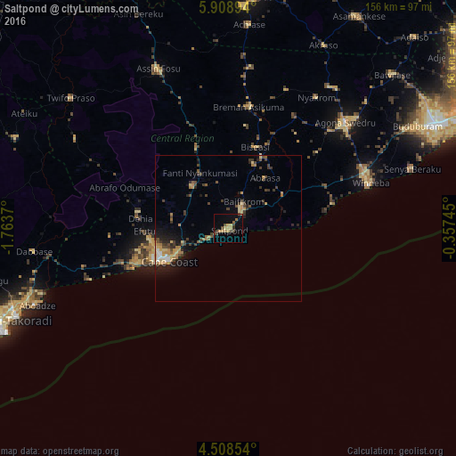
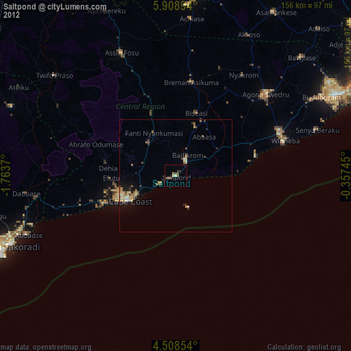
Analysis of Saltpond night lights 2016
Square area 10x10 km:
 0%
0%90-99
0%80-89
2.89%70-79
4.55%60-69
1.65%50-59
1.24%40-49
4.96%30-39
2.69%20-29
0.21%10-19
4.75%0-9
77.07%Square area 50x50 km:
0.22%90-99
0.27%80-89
0.75%70-79
0.99%60-69
0.99%50-59
0.57%40-49
1.1%30-39
1.41%20-29
1.17%10-19
2.59%0-9
89.94%Clear (daylight) street map image can be seen on geolist.org.
Map coordinates:
5° 54' 32.2" North, 1° 45' 49.3" West
5° 12' 32.9" North, 1° 3' 38.1" West
4° 30' 30.7" North, 0° 21' 26.8" West
Some cities around Saltpond sort by population:
• Cape Coast
23.6 km =14.7 mi,  240°
240°
• Swedru
54.1 km =33.6 mi,  47°
47°
• Winneba
50.9 km =31.6 mi,  71°
71°
• Elmina
35 km =21.7 mi,  246°
246°
• Shama Junction
70.2 km =43.6 mi, 252°
• Apam
36.8 km =22.9 mi,  76°
76°
• Foso
60.2 km =37.4 mi,  335°
335°
• Mumford
33.9 km =21.1 mi, 80°
2295672 (p: 24,689)
Sources (retrieved 2019-11-25):
» Earth at Night: Flat Maps 2012, 2016