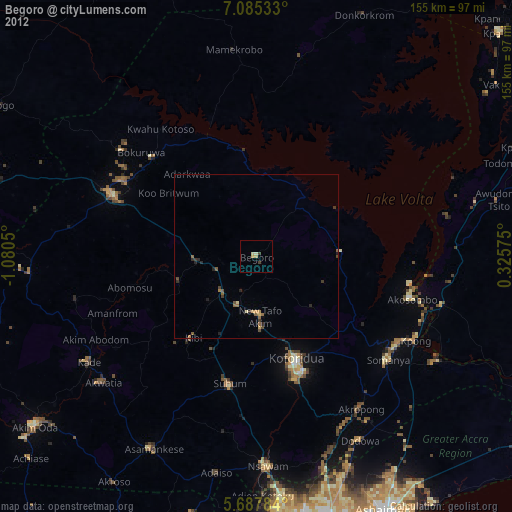
Begoro night lights from space
Night Light of Begoro (Eastern) from space (Ghana) Src. Average luminocity for 10x10km area is 6.0476% and for 50x50km: 1.7971%.
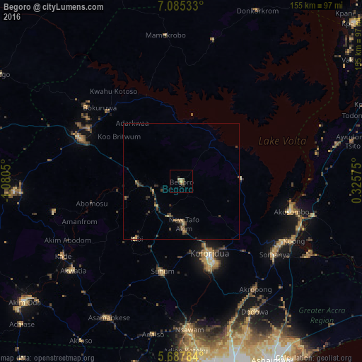
Analysis of Begoro night lights 2016
Square area 10x10 km:
100  0%
0%
90-99 0%
80-89 2.16%
70-79 0.43%
60-69 1.3%
50-59 1.3%
40-49 2.38%
30-39 0.22%
20-29 0.87%
10-19 0%
0-9 91.34%
0%90-99
0%80-89
2.16%70-79
0.43%60-69
1.3%50-59
1.3%40-49
2.38%30-39
0.22%20-29
0.87%10-19
0%0-9
91.34%Square area 50x50 km:
100 0%
90-99 0%
80-89 0.29%
70-79 0.2%
60-69 0.27%
50-59 0.42%
40-49 0.63%
30-39 0.45%
20-29 0.62%
10-19 0.18%
0-9 96.95%
0%90-99
0%80-89
0.29%70-79
0.2%60-69
0.27%50-59
0.42%40-49
0.63%30-39
0.45%20-29
0.62%10-19
0.18%0-9
96.95%Clear (daylight) street map image can be seen on geolist.org.
Map coordinates:
7° 5' 7.2" North, 1° 4' 49.8" West
6° 23' 13.4" North, 0° 22' 38.6" West
5° 41' 16.2" North, 0° 19' 32.7" East
Some cities around Begoro sort by population:
• Koforidua
35.1 km =21.8 mi,  158°
158°
• Suhum
39.3 km =24.4 mi,  191°
191°
• Nsawam
64.4 km =40 mi,  177°
177°
• Akwatia
61.3 km =38.1 mi,  231°
231°
• Aburi
64 km =39.8 mi, 159°
• Akropong
56.1 km =34.9 mi,  144°
144°
• Kibi
31.5 km =19.6 mi,  218°
218°
• Mpraeso
45.6 km =28.3 mi,  300°
300°
2303236 (p: 29,516)
Sources (retrieved 2019-11-25):
» Earth at Night: Flat Maps 2012, 2016