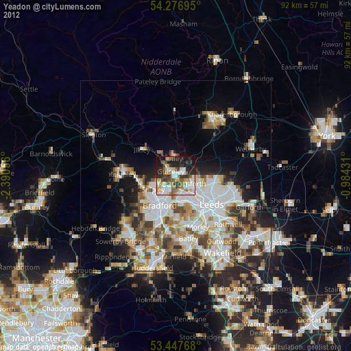
Yeadon night lights from space
Night Light of Yeadon (England) from space (United Kingdom) Src. Average luminocity for 10x10km area is 63.8228% and for 50x50km: 33.0448%.
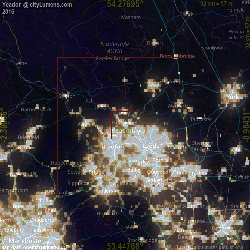
Analysis of Yeadon night lights 2016
Square area 10x10 km:
 14.42%
90-99
16.27%80-89
7.94%70-79
7.41%60-69
7.67%50-59
8.2%40-49
8.99%30-39
10.98%20-29
14.29%10-19
3.84%0-9
0%Square area 50x50 km:
9.12%90-99
7.95%80-89
2.81%70-79
3.34%60-69
4.23%50-59
4.05%40-49
3.78%30-39
4.24%20-29
5.01%10-19
7.72%0-9
47.75%Clear (daylight) street map image can be seen on geolist.org.
Map coordinates:
54° 16' 37" North, 2° 23' 26" West
53° 51' 51.7" North, 1° 41' 14.7" West
53° 26' 51.6" North, 0° 59' 3.5" West
Some cities around Yeadon sort by population:
• Bradford
8.9 km =5.5 mi,  208°
208°
• Pudsey
7.9 km =4.9 mi,  167°
167°
• Shipley
6.2 km =3.9 mi,  236°
236°
• Guiseley
2.1 km =1.3 mi,  307°
307°
• Horsforth
4.1 km =2.5 mi,  126°
126°
• Baildon
6.9 km =4.3 mi,  253°
253°
• Otley
4.6 km =2.9 mi,  354°
354°
• Burley in Wharfedale
6.9 km =4.3 mi,  317°
317°
2633397 (p: 37,379)
Sources (retrieved 2019-11-25):
» Earth at Night: Flat Maps 2012, 2016