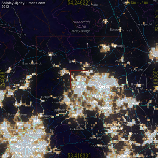
Shipley night lights from space
Night Light of Shipley (England) from space (United Kingdom) Src. Average luminocity for 10x10km area is 72.3148% and for 50x50km: 32.5341%.
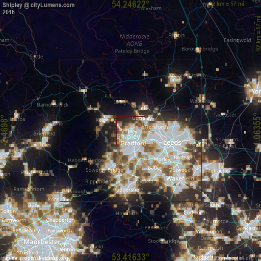
Analysis of Shipley night lights 2016
Square area 10x10 km:
100  22.22%
90-99 20.37%
80-89 6.48%
70-79 8.07%
60-69 9.39%
50-59 8.86%
40-49 7.14%
30-39 5.56%
20-29 8.99%
10-19 2.91%
0-9 0%
22.22%90-99
20.37%80-89
6.48%70-79
8.07%60-69
9.39%50-59
8.86%40-49
7.14%30-39
5.56%20-29
8.99%10-19
2.91%0-9
0%Square area 50x50 km:
100 8.73%
90-99 7.61%
80-89 2.83%
70-79 3.36%
60-69 4.08%
50-59 4.07%
40-49 3.66%
30-39 4.31%
20-29 6.14%
10-19 8.29%
0-9 46.91%
8.73%90-99
7.61%80-89
2.83%70-79
3.36%60-69
4.08%50-59
4.07%40-49
3.66%30-39
4.31%20-29
6.14%10-19
8.29%0-9
46.91%Clear (daylight) street map image can be seen on geolist.org.
Map coordinates:
54° 14' 46.4" North, 2° 28' 11.3" West
53° 49' 60" North, 1° 46' 0" West
53° 24' 58.8" North, 1° 3' 48.8" West
Some cities around Shipley sort by population:
• Bradford
4.5 km =2.8 mi,  167°
167°
• Yeadon
6.2 km =3.9 mi,  56°
56°
• Pudsey
8.1 km =5 mi,  121°
121°
• Guiseley
5.9 km =3.7 mi,  37°
37°
• Bingley
5 km =3.1 mi,  289°
289°
• Horsforth
8.5 km =5.3 mi,  83°
83°
• Baildon
2.1 km =1.3 mi,  317°
317°
• Wilsden
6.3 km =3.9 mi,  257°
257°
2637958 (p: 28,544)
Sources (retrieved 2019-11-25):
» Earth at Night: Flat Maps 2012, 2016