Otley night lights from space
Night Light of Otley (England) from space (United Kingdom) Src. Average luminocity for 10x10km area is 33.369% and for 50x50km: 28.4195%.
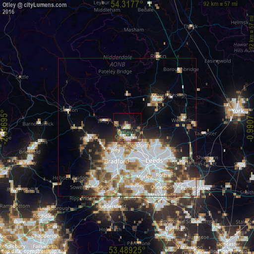
Analysis of Otley night lights 2016
Square area 10x10 km:
 5.03%
5.03%90-99
3.7%80-89
4.5%70-79
2.65%60-69
3.44%50-59
4.89%40-49
6.22%30-39
10.05%20-29
15.74%10-19
17.99%0-9
25.79%Square area 50x50 km:
7.95%90-99
6.85%80-89
2.35%70-79
3%60-69
3.7%50-59
3.55%40-49
3.19%30-39
3.03%20-29
3.7%10-19
7.13%0-9
55.57%Clear (daylight) street map image can be seen on geolist.org.
Map coordinates:
54° 19' 3.7" North, 2° 23' 49" West
53° 54' 19.9" North, 1° 41' 37.8" West
53° 29' 21.3" North, 0° 59' 26.5" West
Some cities around Otley sort by population:
• Yeadon
4.6 km =2.9 mi,  174°
174°
• Shipley
9.3 km =5.8 mi,  210°
210°
• Guiseley
3.5 km =2.2 mi,  200°
200°
• Bingley
11.4 km =7.1 mi,  236°
236°
• Horsforth
7.9 km =4.9 mi,  152°
152°
• Baildon
9 km =5.6 mi,  223°
223°
• Ilkley
8.7 km =5.4 mi,  283°
283°
• Burley in Wharfedale
4.2 km =2.6 mi, 277°
2640857 (p: 14,668)
Sources (retrieved 2019-11-25):
» Earth at Night: Flat Maps 2012, 2016