Yatton night lights from space
Night Light of Yatton (England) from space (United Kingdom) Src. Average luminocity for 10x10km area is 3.2437% and for 50x50km: 17.4396%.
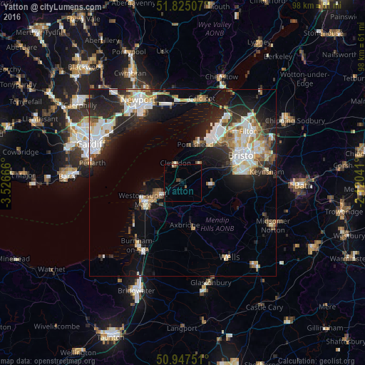
Analysis of Yatton night lights 2016
Square area 10x10 km:
 0%
0%90-99
0.42%80-89
0.42%70-79
0%60-69
0.42%50-59
0.7%40-49
0.7%30-39
0.98%20-29
0%10-19
0.56%0-9
95.8%Square area 50x50 km:
3.59%90-99
3.98%80-89
1.59%70-79
1.75%60-69
1.56%50-59
2%40-49
1.71%30-39
1.89%20-29
5.63%10-19
9.8%0-9
66.49%Clear (daylight) street map image can be seen on geolist.org.
Map coordinates:
51° 49' 30.3" North, 3° 31' 36" West
51° 23' 18.2" North, 2° 49' 24.7" West
50° 56' 51" North, 2° 7' 13.5" West
Some cities around Yatton sort by population:
• Bristol
17.4 km =10.8 mi,  64°
64°
• Weston-super-Mare
11.6 km =7.2 mi,  246°
246°
• Portishead
11.1 km =6.9 mi,  19°
19°
• Clevedon
6.4 km =4 mi,  338°
338°
• Nailsea
6.7 km =4.2 mi,  42°
42°
• Bishopsworth
14.4 km =8.9 mi,  78°
78°
• Long Ashton
12.2 km =7.6 mi,  67°
67°
• Cheddar
13 km =8.1 mi,  165°
165°
2633404 (p: 10,251)
Sources (retrieved 2019-11-25):
» Earth at Night: Flat Maps 2012, 2016