Long Ashton night lights from space
Night Light of Long Ashton (England) from space (United Kingdom) Src. Average luminocity for 10x10km area is 35.9118% and for 50x50km: 15.7606%.
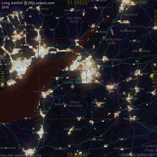
Analysis of Long Ashton night lights 2016
Square area 10x10 km:
 9.09%
9.09%90-99
7.62%80-89
4.28%70-79
2.01%60-69
2.01%50-59
2.81%40-49
2.01%30-39
6.28%20-29
17.38%10-19
22.06%0-9
24.47%Square area 50x50 km:
2.75%90-99
3.24%80-89
1.4%70-79
1.75%60-69
1.71%50-59
2.17%40-49
1.79%30-39
1.97%20-29
4.2%10-19
8.65%0-9
70.37%Clear (daylight) street map image can be seen on geolist.org.
Map coordinates:
51° 51' 58.5" North, 3° 21' 50.8" West
51° 25' 47.9" North, 2° 39' 39.5" West
50° 59' 22.2" North, 1° 57' 28.3" West
Some cities around Long Ashton sort by population:
• Bristol
5.3 km =3.3 mi,  57°
57°
• Kingswood
10.9 km =6.8 mi,  76°
76°
• Mangotsfield
12.6 km =7.8 mi, 59°
• Portishead
9.5 km =5.9 mi,  307°
307°
• Nailsea
6.8 km =4.2 mi,  272°
272°
• Keynsham
11.5 km =7.1 mi,  98°
98°
• Bishopsworth
3.3 km =2.1 mi,  121°
121°
• Yatton
12.2 km =7.6 mi,  247°
247°
2643726 (p: 5,254)
Sources (retrieved 2019-11-25):
» Earth at Night: Flat Maps 2012, 2016