Portishead night lights from space
Night Light of Portishead (England) from space (United Kingdom) Src. Average luminocity for 10x10km area is 21.893% and for 50x50km: 17.3173%.
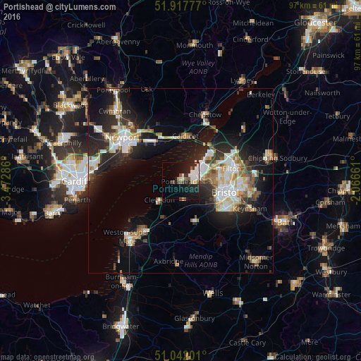
Analysis of Portishead night lights 2016
Square area 10x10 km:
 4.81%
4.81%90-99
5.08%80-89
1.34%70-79
0.53%60-69
2.14%50-59
2.27%40-49
3.07%30-39
0.94%20-29
8.02%10-19
20.59%0-9
51.2%Square area 50x50 km:
3.08%90-99
3.68%80-89
1.52%70-79
1.75%60-69
1.68%50-59
2.13%40-49
1.97%30-39
2.21%20-29
5.78%10-19
11.06%0-9
65.14%Clear (daylight) street map image can be seen on geolist.org.
Map coordinates:
51° 55' 4" North, 3° 28' 22.3" West
51° 28' 55.2" North, 2° 46' 11" West
51° 2' 31.2" North, 2° 3' 59.8" West
Some cities around Portishead sort by population:
• Bristol
12.4 km =7.7 mi,  103°
103°
• Clevedon
7.5 km =4.7 mi,  234°
234°
• Nailsea
5.6 km =3.5 mi,  171°
171°
• Caldicot
11.7 km =7.3 mi,  4°
4°
• Yatton
11.1 km =6.9 mi,  199°
199°
• Magor
11.6 km =7.2 mi,  338°
338°
• Undy
10.8 km =6.7 mi, 343°
• Long Ashton
9.5 km =5.9 mi,  127°
127°
2640037 (p: 23,699)
Sources (retrieved 2019-11-25):
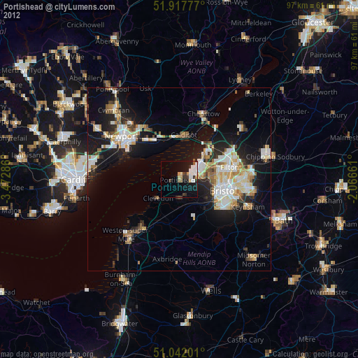
» Earth at Night: Flat Maps 2012, 2016