Weston-super-Mare night lights from space
Night Light of Weston-super-Mare (England) from space (United Kingdom) Src. Average luminocity for 10x10km area is 19.7339% and for 50x50km: 13.8638%.
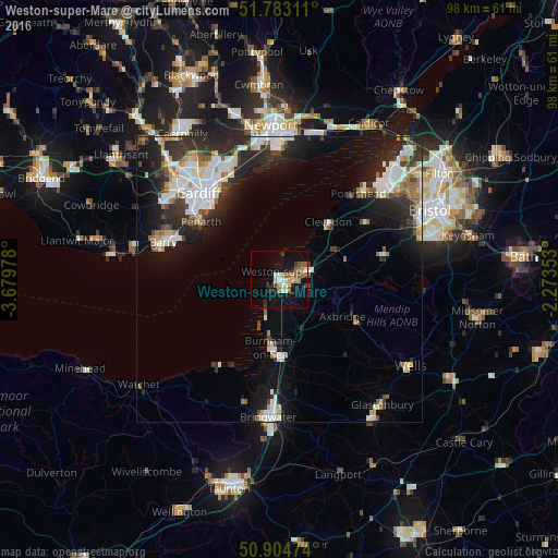
Analysis of Weston-super-Mare night lights 2016
Square area 10x10 km:
 1.82%
1.82%90-99
3.78%80-89
0.7%70-79
2.94%60-69
3.08%50-59
4.76%40-49
2.52%30-39
1.4%20-29
2.66%10-19
20.45%0-9
55.88%Square area 50x50 km:
2.93%90-99
3.09%80-89
0.94%70-79
1.18%60-69
1.17%50-59
1.37%40-49
1.53%30-39
2.14%20-29
5.07%10-19
8.27%0-9
72.32%Clear (daylight) street map image can be seen on geolist.org.
Map coordinates:
51° 46' 59.2" North, 3° 40' 47.2" West
51° 20' 45.7" North, 2° 58' 35.9" West
50° 54' 17.1" North, 2° 16' 24.7" West
Some cities around Weston-super-Mare sort by population:
• Cardiff
20.5 km =12.7 mi,  316°
316°
• Penarth
17.1 km =10.6 mi,  307°
307°
• Burnham-on-Sea
12 km =7.5 mi,  187°
187°
• Clevedon
13.5 km =8.4 mi,  37°
37°
• Nailsea
17.9 km =11.1 mi,  57°
57°
• Yatton
11.6 km =7.2 mi,  66°
66°
• Dinas Powys
19.2 km =11.9 mi,  300°
300°
• Cheddar
16 km =9.9 mi,  119°
119°
2634308 (p: 82,903)
Sources (retrieved 2019-11-25):
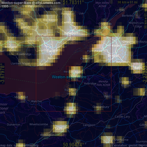
» NASA, Earths city lights 1995
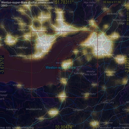
» NASA city lights 2003
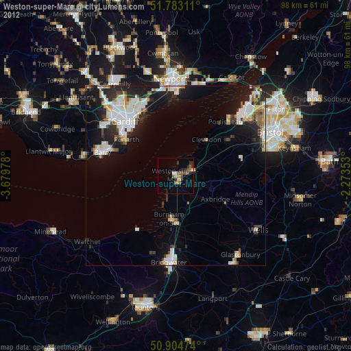
» Earth at Night: Flat Maps 2012, 2016