Wroughton night lights from space
Night Light of Wroughton (England) from space (United Kingdom) Src. Average luminocity for 10x10km area is 34.1992% and for 50x50km: 5.9043%.
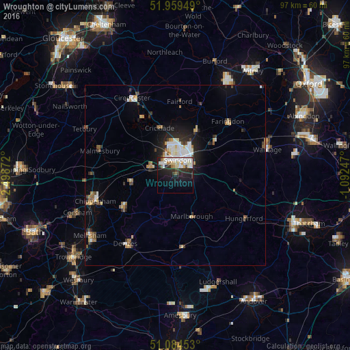
Analysis of Wroughton night lights 2016
Square area 10x10 km:
 9.36%
9.36%90-99
10.03%80-89
3.07%70-79
1.47%60-69
2.27%50-59
1.34%40-49
2.01%30-39
2.94%20-29
12.7%10-19
20.99%0-9
33.82%Square area 50x50 km:
1.05%90-99
1.17%80-89
0.49%70-79
0.56%60-69
0.73%50-59
0.45%40-49
0.71%30-39
0.62%20-29
1.63%10-19
3.27%0-9
89.31%Clear (daylight) street map image can be seen on geolist.org.
Map coordinates:
51° 57' 34.2" North, 2° 29' 55.4" West
51° 31' 26.8" North, 1° 47' 44.1" West
51° 5' 4.3" North, 1° 5' 32.9" West
Some cities around Wroughton sort by population:
• Swindon
3.9 km =2.4 mi,  14°
14°
• Calne
17.4 km =10.8 mi,  236°
236°
• Royal Wootton Bassett
7.8 km =4.8 mi,  284°
284°
• Marlborough
12.4 km =7.7 mi,  158°
158°
• Highworth
13.2 km =8.2 mi,  26°
26°
• Faringdon
20.6 km =12.8 mi,  44°
44°
• Malmesbury
21.8 km =13.5 mi,  287°
287°
• Lyneham
11.9 km =7.4 mi,  266°
266°
2633476 (p: 6,474)
Sources (retrieved 2019-11-25):
» Earth at Night: Flat Maps 2012, 2016