Calne night lights from space
Night Light of Calne (England) from space (United Kingdom) Src. Average luminocity for 10x10km area is 4.1898% and for 50x50km: 7.2163%.
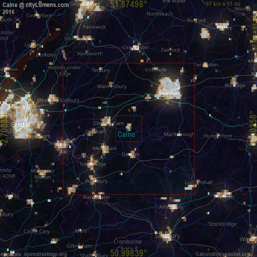
Analysis of Calne night lights 2016
Square area 10x10 km:
 0%
0%90-99
0.53%80-89
0.53%70-79
0%60-69
1.6%50-59
1.07%40-49
0%30-39
1.07%20-29
0.13%10-19
0.4%0-9
94.65%Square area 50x50 km:
1.1%90-99
1.26%80-89
0.57%70-79
0.68%60-69
1%50-59
0.81%40-49
1.03%30-39
0.81%20-29
1.88%10-19
3.87%0-9
87.01%Clear (daylight) street map image can be seen on geolist.org.
Map coordinates:
51° 52' 29.9" North, 2° 42' 31.8" West
51° 26' 19.6" North, 2° 0' 20.6" West
50° 59' 54.2" North, 1° 18' 9.3" West
Some cities around Calne sort by population:
• Chippenham
8.6 km =5.3 mi,  285°
285°
• Melksham
11.9 km =7.4 mi,  231°
231°
• Devizes
9.8 km =6.1 mi,  175°
175°
• Neston
13.8 km =8.6 mi,  257°
257°
• Corsham
12.4 km =7.7 mi,  267°
267°
• Royal Wootton Bassett
13.4 km =8.3 mi,  31°
31°
• Malmesbury
17.1 km =10.6 mi,  338°
338°
• Lyneham
9.1 km =5.7 mi,  17°
17°
2653974 (p: 17,274)
Sources (retrieved 2019-11-25):
» Earth at Night: Flat Maps 2012, 2016