Malmesbury night lights from space
Night Light of Malmesbury (England) from space (United Kingdom) Src. Average luminocity for 10x10km area is 1.361% and for 50x50km: 6.81%.
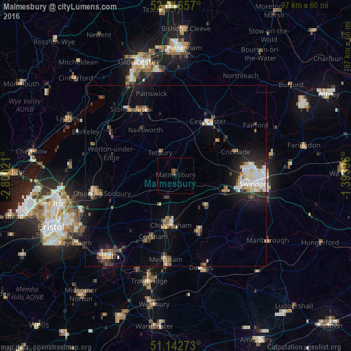
Analysis of Malmesbury night lights 2016
Square area 10x10 km:
 0%
0%90-99
0%80-89
0%70-79
0%60-69
0%50-59
1.07%40-49
0.53%30-39
0.94%20-29
0.13%10-19
0%0-9
97.33%Square area 50x50 km:
0.99%90-99
1.22%80-89
0.44%70-79
0.63%60-69
0.97%50-59
0.71%40-49
1.06%30-39
0.89%20-29
1.65%10-19
3.84%0-9
87.6%Clear (daylight) street map image can be seen on geolist.org.
Map coordinates:
52° 0' 59.7" North, 2° 48' 0.8" West
51° 34' 54.3" North, 2° 5' 49.5" West
51° 8' 33.8" North, 1° 23' 38.3" West
Some cities around Malmesbury sort by population:
• Chippenham
13.7 km =8.5 mi,  188°
188°
• Calne
17.1 km =10.6 mi,  158°
158°
• Corsham
17.5 km =10.9 mi,  200°
200°
• Royal Wootton Bassett
14 km =8.7 mi,  108°
108°
• Chalford
16.5 km =10.3 mi,  346°
346°
• Tetbury
7.8 km =4.8 mi,  324°
324°
• Lyneham
11.6 km =7.2 mi,  128°
128°
• Nailsworth
15.1 km =9.4 mi,  325°
325°
2643146 (p: 6,318)
Sources (retrieved 2019-11-25):
» Earth at Night: Flat Maps 2012, 2016