Winsford night lights from space
Night Light of Winsford (England) from space (United Kingdom) Src. Average luminocity for 10x10km area is 25.6553% and for 50x50km: 26.9155%.
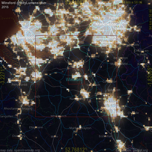
Analysis of Winsford night lights 2016
Square area 10x10 km:
 3.79%
3.79%90-99
4.29%80-89
2.65%70-79
1.14%60-69
1.14%50-59
1.89%40-49
3.03%30-39
1.89%20-29
16.04%10-19
42.3%0-9
21.84%Square area 50x50 km:
6.59%90-99
6.38%80-89
2.47%70-79
2.18%60-69
2.38%50-59
2.55%40-49
3.36%30-39
4.25%20-29
6.84%10-19
13.98%0-9
49.01%Clear (daylight) street map image can be seen on geolist.org.
Map coordinates:
53° 36' 38.4" North, 3° 13' 37.6" West
53° 11' 29.3" North, 2° 31' 26.3" West
52° 46' 5.2" North, 1° 49' 15.1" West
Some cities around Winsford sort by population:
• Crewe
11.8 km =7.3 mi,  152°
152°
• Northwich
7.5 km =4.7 mi,  1°
1°
• Sandbach
11.9 km =7.4 mi,  115°
115°
• Nantwich
13.6 km =8.5 mi,  179°
179°
• Middlewich
5.3 km =3.3 mi,  88°
88°
• Knutsford
15.9 km =9.9 mi,  38°
38°
• Weaverham
8.3 km =5.2 mi,  336°
336°
• Holmes Chapel
11.1 km =6.9 mi,  84°
84°
2633810 (p: 30,259)
Sources (retrieved 2019-11-25):
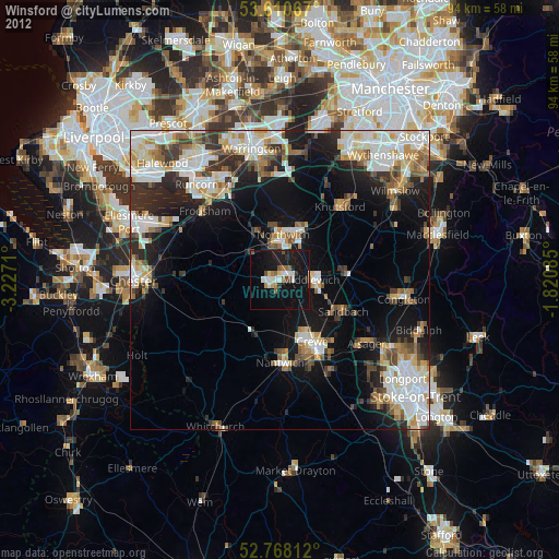
» Earth at Night: Flat Maps 2012, 2016