Crewe night lights from space
Night Light of Crewe (England) from space (United Kingdom) Src. Average luminocity for 10x10km area is 33.7526% and for 50x50km: 14.7484%.
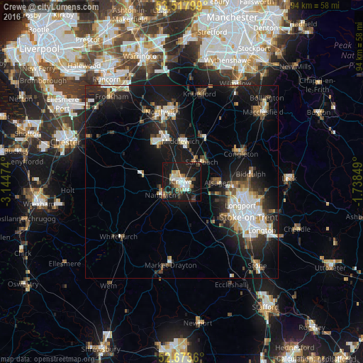
Analysis of Crewe night lights 2016
Square area 10x10 km:
 5.42%
5.42%90-99
5.82%80-89
3.31%70-79
3.44%60-69
4.1%50-59
4.23%40-49
5.16%30-39
3.57%20-29
6.35%10-19
46.43%0-9
12.17%Square area 50x50 km:
2.57%90-99
2.62%80-89
1.42%70-79
1.16%60-69
1.35%50-59
1.77%40-49
1.88%30-39
2.15%20-29
4.73%10-19
13.94%0-9
66.4%Clear (daylight) street map image can be seen on geolist.org.
Map coordinates:
53° 31' 4.8" North, 3° 8' 41.1" West
53° 5' 52.3" North, 2° 26' 29.8" West
52° 40' 25" North, 1° 44' 18.6" West
Some cities around Crewe sort by population:
• Winsford
11.8 km =7.3 mi,  332°
332°
• Kidsgrove
13.7 km =8.5 mi,  95°
95°
• Sandbach
7.4 km =4.6 mi,  45°
45°
• Nantwich
6.2 km =3.9 mi,  238°
238°
• Middlewich
10.6 km =6.6 mi,  359°
359°
• Alsager
9 km =5.6 mi,  91°
91°
• Audley
10.9 km =6.8 mi,  119°
119°
• Holmes Chapel
12.8 km =8 mi,  25°
25°
2652002 (p: 75,556)
Sources (retrieved 2019-11-25):
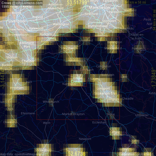
» NASA, Earths city lights 1995
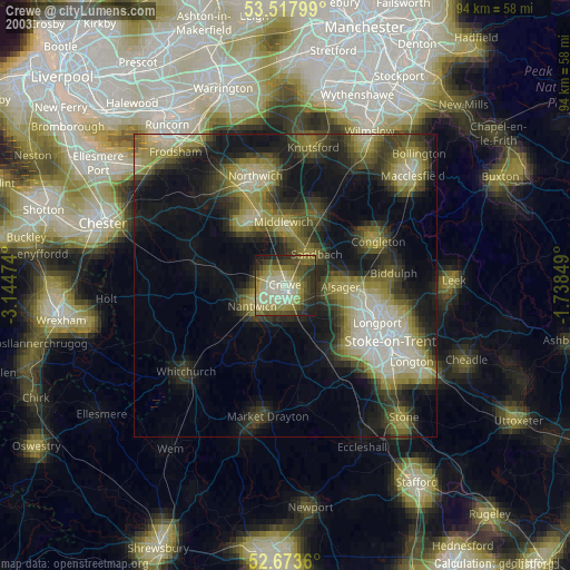
» NASA city lights 2003
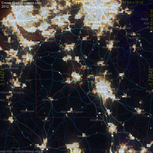
» Earth at Night: Flat Maps 2012, 2016