Northwich night lights from space
Night Light of Northwich (England) from space (United Kingdom) Src. Average luminocity for 10x10km area is 33.7626% and for 50x50km: 35.4552%.
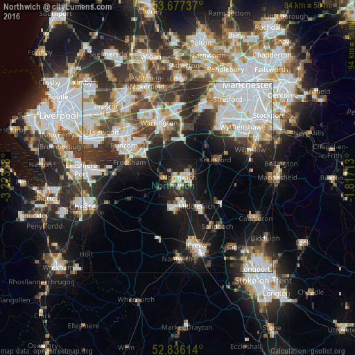
Analysis of Northwich night lights 2016
Square area 10x10 km:
 3.54%
3.54%90-99
5.68%80-89
4.17%70-79
4.67%60-69
2.9%50-59
3.16%40-49
4.92%30-39
4.29%20-29
18.06%10-19
38.38%0-9
10.23%Square area 50x50 km:
9.92%90-99
8.52%80-89
3.12%70-79
2.94%60-69
3.17%50-59
3.3%40-49
4.42%30-39
5.55%20-29
7.99%10-19
13.75%0-9
37.32%Clear (daylight) street map image can be seen on geolist.org.
Map coordinates:
53° 40' 38.5" North, 3° 13' 24.2" West
53° 15' 31.8" North, 2° 31' 12.9" West
52° 50' 10.1" North, 1° 49' 1.7" West
Some cities around Northwich sort by population:
• Winsford
7.5 km =4.7 mi,  181°
181°
• Middlewich
8.9 km =5.5 mi,  145°
145°
• Knutsford
10.8 km =6.7 mi,  63°
63°
• Lymm
13.9 km =8.6 mi,  11°
11°
• Grappenhall
12.7 km =7.9 mi,  352°
352°
• Stockton Heath
13 km =8.1 mi,  343°
343°
• Weaverham
3.5 km =2.2 mi,  272°
272°
• Holmes Chapel
12.6 km =7.8 mi,  120°
120°
2641224 (p: 47,421)
Sources (retrieved 2019-11-25):
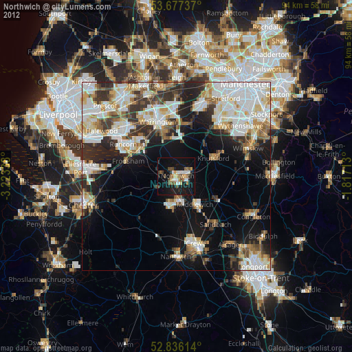
» Earth at Night: Flat Maps 2012, 2016